MyTopo
Olyphant Arkansas US Topo Map
Couldn't load pickup availability
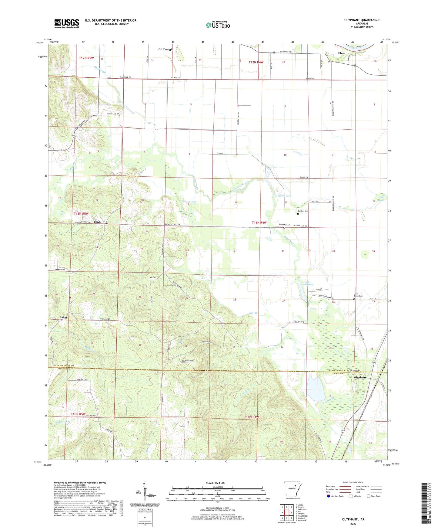
2024 topographic map quadrangle Olyphant in the state of Arkansas. Scale: 1:24000. Based on the newly updated USGS 7.5' US Topo map series, this map is in the following counties: Independence, Jackson. The map contains contour data, water features, and other items you are used to seeing on USGS maps, but also has updated roads and other features. This is the next generation of topographic maps. Printed on high-quality waterproof paper with UV fade-resistant inks.
Quads adjacent to this one:
West: Huff
Northwest: Salado
North: Newark
Northeast: Jacksonport
East: Newport
Southeast: Augusta NE
South: Bradford
Southwest: Velvet Ridge
This map covers the same area as the classic USGS quad with code o35091e4.
Contains the following named places: Amos Airport, Bailey, Blackland Chapel, Blue Creek, Brown Lake, Elmo, Fife Slough, Grassy Lake, Hall Creek, Hindman Cemetery, Hog Pond, Lake Whitstine, Lone Beech Cemetery, Meadow Lake, Meadow Lake Church, Olyphant, Sanders Cemetery, Thida, Thida Post Office, Township of Departee, Township of Oil Trough, Union Hill - Thida Fire Department, ZIP Codes: 72165, 72564