MyTopo
Augusta Arkansas US Topo Map
Couldn't load pickup availability
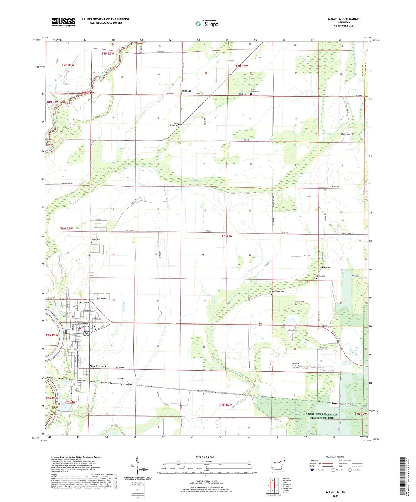
2024 topographic map quadrangle Augusta in the state of Arkansas. Scale: 1:24000. Based on the newly updated USGS 7.5' US Topo map series, this map is in the following counties: Woodruff, White, Jackson. The map contains contour data, water features, and other items you are used to seeing on USGS maps, but also has updated roads and other features. This is the next generation of topographic maps. Printed on high-quality waterproof paper with UV fade-resistant inks.
Quads adjacent to this one:
West: Augusta SW
Northwest: Bradford
North: Augusta NE
Northeast: Tupelo
East: McCrory
Southeast: Grays
South: Gregory
Southwest: Georgetown
This map covers the same area as the classic USGS quad with code o35091c3.
Contains the following named places: Augusta, Augusta Elementary School, Augusta Heliport, Augusta High School, Augusta Police Department, Augusta Post Office, Augusta Presbyterian Church, Augusta Volunteer Fire Department, Blockade Hill, Caney Creek, Cavell, City of Augusta, Conner High School, Cypress Brake, Cypress Creek Country Club, First Baptist Church of Augusta, Fitzhugh, Fitzhugh Post Office, Frame Spur, Holly Grove Cemetery, Holly Grove Church, Jelks Cemetery, Mount Olive Cemetery, Mount Olive Church, Negro Head Corner, New Augusta, New Salem, New Salem Cemetery, New Salem Church, Quiett Cemetery, Southern Paramedic Service Augusta, Taggart Landing Strip, Township of Augusta, Union, Union Cemetery, Woodruff County Airport, Woodruff County Courthouse, Woodruff County School, Woodruff County Sheriff's Office