MyTopo
Buckner Arkansas US Topo Map
Couldn't load pickup availability
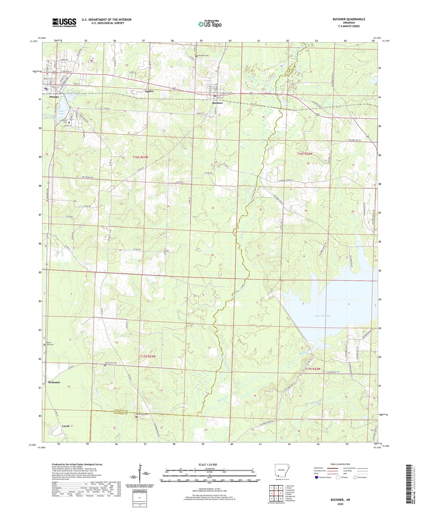
2024 topographic map quadrangle Buckner in the state of Arkansas. Scale: 1:24000. Based on the newly updated USGS 7.5' US Topo map series, this map is in the following counties: Lafayette, Columbia. The map contains contour data, water features, and other items you are used to seeing on USGS maps, but also has updated roads and other features. This is the next generation of topographic maps. Printed on high-quality waterproof paper with UV fade-resistant inks.
Quads adjacent to this one:
West: Lewisville
Northwest: Old Town
North: Falcon
Northeast: Lamartine
East: Waldo
Southeast: Macedonia
South: Bussey
Southwest: Bradley NE
This map covers the same area as the classic USGS quad with code o33093c4.
Contains the following named places: Apalco, Arkansas Forestry Commission Fire District 4, Beech Creek, Buckner, Buckner Cemetery, Buckner Oil and Gas Field, Buckner Post Office, City of Buckner, City of Stamps, Clear Creek, County Line Church, Lafayette County East Elementary School, Lafayette County High School, Lake Columbia, Lake June, Lake June Dam, Lakeside Cemetery, Lerch, Liberty Church, McKamie, Mount Vernon, Mount Vernon Church, Mount Zion Cemetery, Mount Zion Church, Oak Grove Cemetery, Oak Grove Church, Patterson Cemetery, Stamps, Stamps Elementary School, Stamps High School, Stamps Police Department, Stamps Post Office, Stamps Volunteer Fire Department, Strange Lake, Strange Lake Dam, Township of Clay, Township of Hadley, ZIP Code: 71860