MyTopo
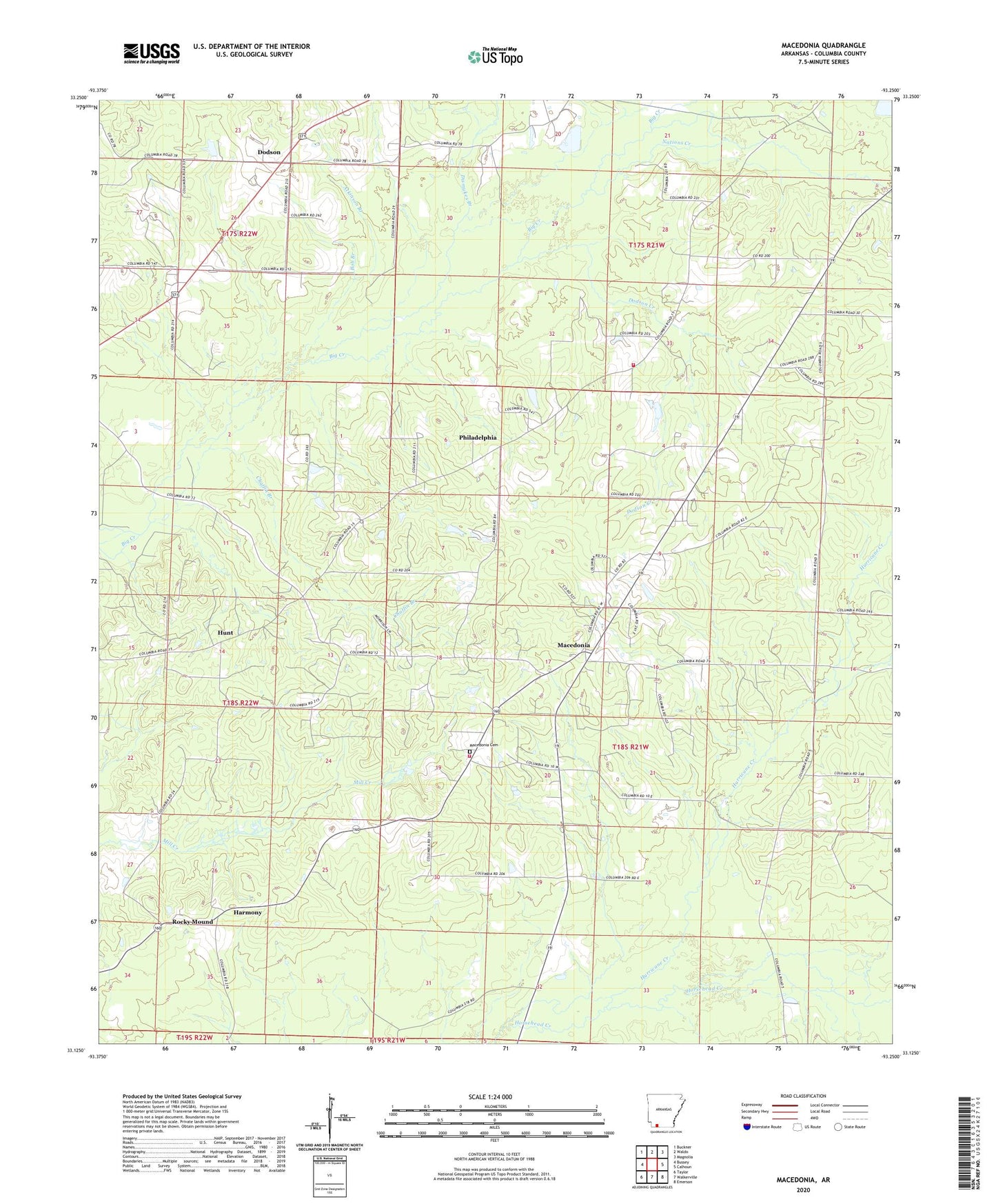
Macedonia Arkansas US Topo Map
Couldn't load pickup availability
2024 topographic map quadrangle Macedonia in the state of Arkansas. Scale: 1:24000. Based on the newly updated USGS 7.5' US Topo map series, this map is in the following counties: Columbia. The map contains contour data, water features, and other items you are used to seeing on USGS maps, but also has updated roads and other features. This is the next generation of topographic maps. Printed on high-quality waterproof paper with UV fade-resistant inks.
Quads adjacent to this one:
West: Bussey
Northwest: Buckner
North: Waldo
Northeast: Magnolia
East: Calhoun
Southeast: Emerson
South: Walkerville
Southwest: Taylor
This map covers the same area as the classic USGS quad with code o33093b3.
Contains the following named places: Antioch Church, Antioch School, Atkinson Branch, Barges Chapel, Bob Branch, Buena Vista School, Burden School, Chaffin Branch, Dismukes Branch, Dodson, Dodson Creek, Dorcheat Macedonia Oil Field, Fears School, Harmony, Harmony United Methodist Church, Hunt, Hurricane Creek, Lone Beach School, Macedonia, Macedonia - Dorcheat Fire Station 2, Macedonia - Dorcheat Volunteer Fire Department, Macedonia Cemetery, Macedonia Church, Macedonia School, Mount Superior Church, Nations Creek, New Vernon School, New Zion Church, Philadelphia, Philadelphia United Methodist Church, Pilgrims Rest Church, Pleasant Hill Church, Rocky Mound, Rocky Mound School, Spring Branch, Township of Buena Vista, Township of Magnolia