MyTopo
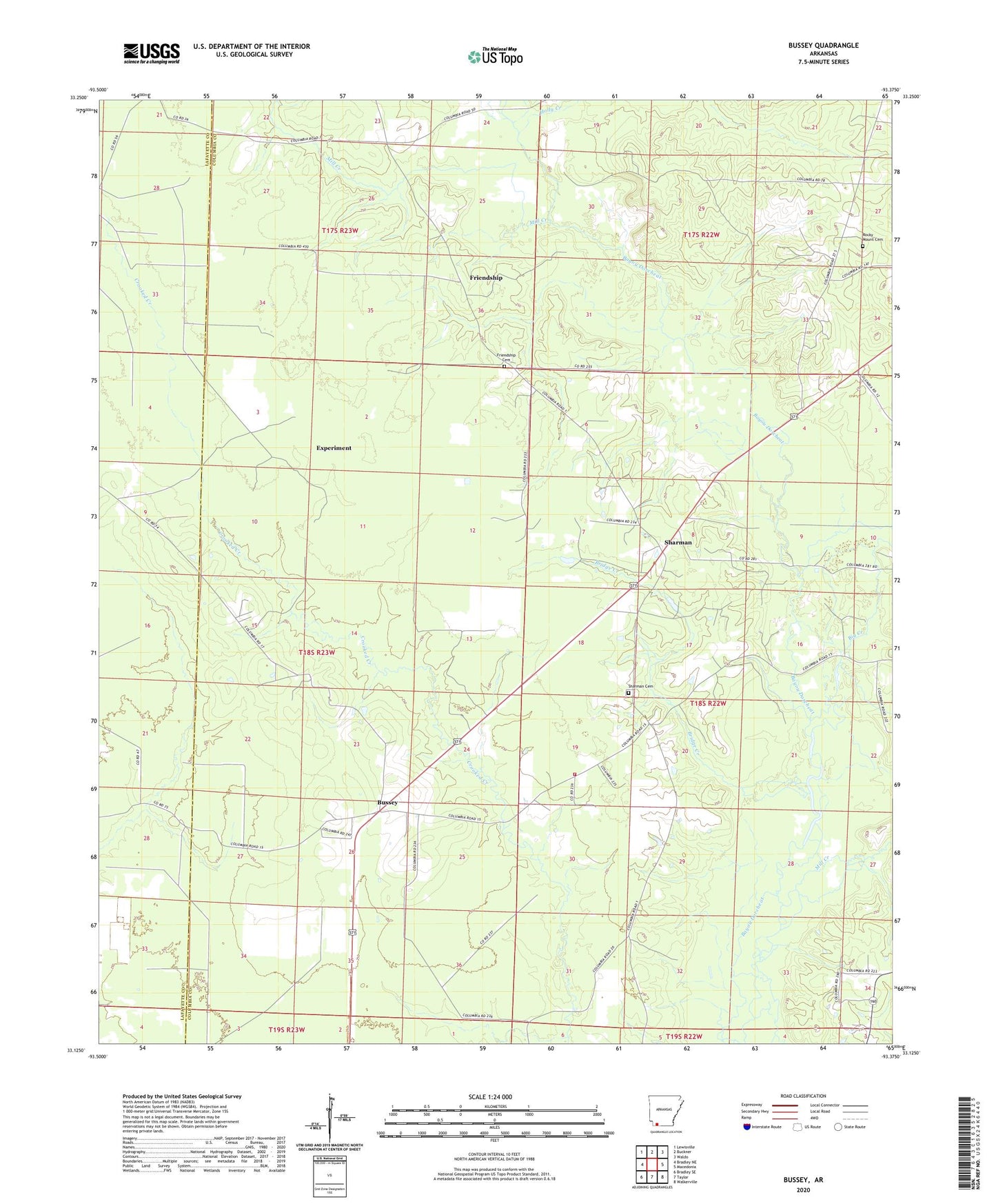
Bussey Arkansas US Topo Map
Couldn't load pickup availability
2024 topographic map quadrangle Bussey in the state of Arkansas. Scale: 1:24000. Based on the newly updated USGS 7.5' US Topo map series, this map is in the following counties: Columbia, Lafayette. The map contains contour data, water features, and other items you are used to seeing on USGS maps, but also has updated roads and other features. This is the next generation of topographic maps. Printed on high-quality waterproof paper with UV fade-resistant inks.
Quads adjacent to this one:
West: Bradley NE
Northwest: Lewisville
North: Buckner
Northeast: Waldo
East: Macedonia
Southeast: Walkerville
South: Taylor
Southwest: Bradley SE
This map covers the same area as the classic USGS quad with code o33093b4.
Contains the following named places: Beacon Church, Big Creek, Bridge Creek, Bussey, Bussey - Sharman Fire Station, Corinth Church, Experiment, Friendship, Friendship Cemetery, Friendship Church, Holly Creek, McKamie Patton Oil Field, Mill Creek, Robertson School, Rocky Mount Cemetery, Rocky Mount Church, Sharman, Sharman Cemetery, Sharman Church, Smithland, Township of Georgia, Township of Taylor, Wise School, Woodard School