MyTopo
Bunn Arkansas US Topo Map
Couldn't load pickup availability
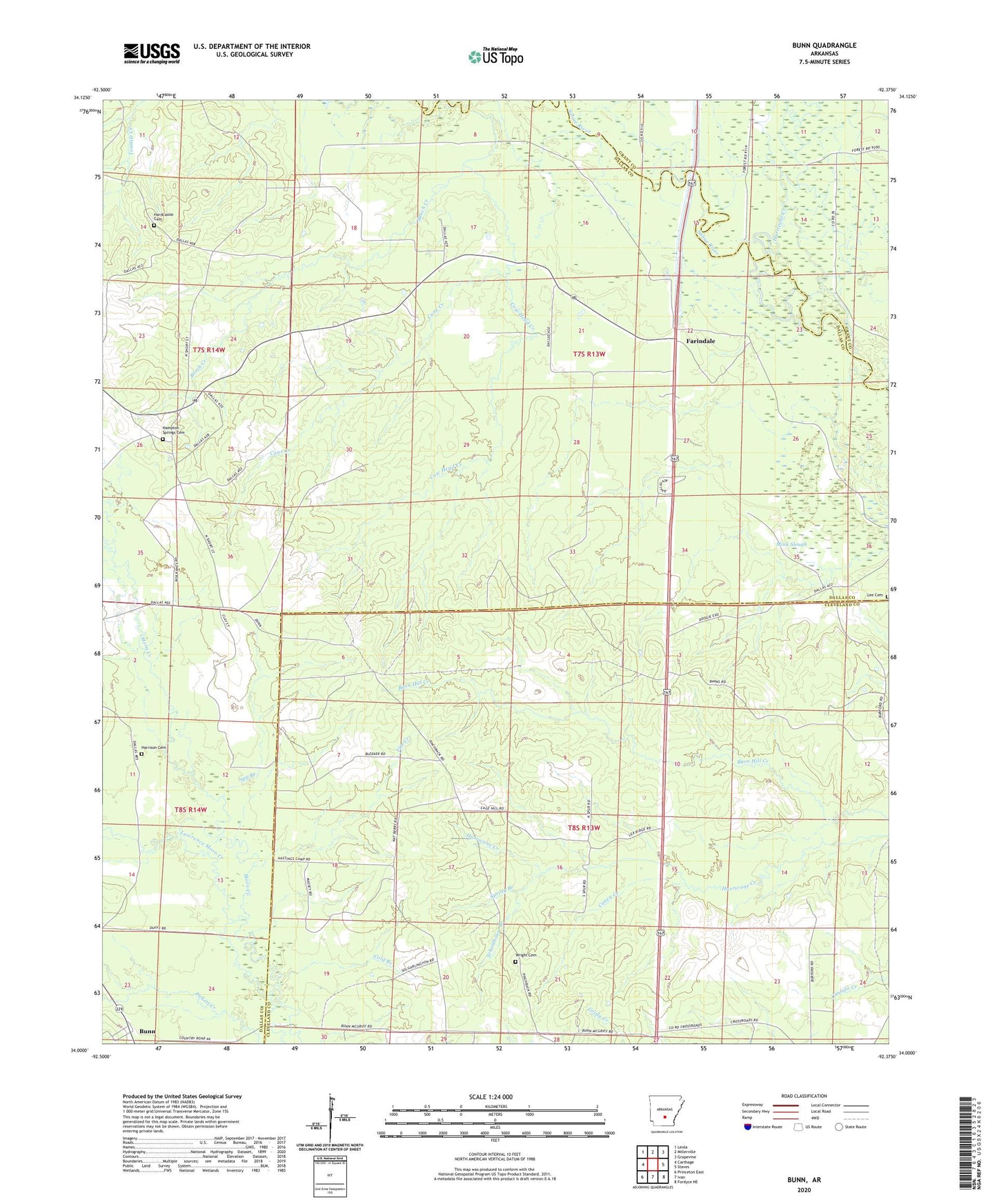
2024 topographic map quadrangle Bunn in the state of Arkansas. Scale: 1:24000. Based on the newly updated USGS 7.5' US Topo map series, this map is in the following counties: Dallas, Cleveland, Grant. The map contains contour data, water features, and other items you are used to seeing on USGS maps, but also has updated roads and other features. This is the next generation of topographic maps. Printed on high-quality waterproof paper with UV fade-resistant inks.
Quads adjacent to this one:
West: Carthage
Northwest: Leola
North: Millerville
Northeast: Grapevine
East: Staves
Southeast: Fordyce NE
South: Ivan
Southwest: Princeton East
This map covers the same area as the classic USGS quad with code o34092a4.
Contains the following named places: Beech Creek, Bleaker, Bunn, Cane Creek, Caney Creek, Cold Branch, Cow Head Creek, Croak, Farindale, Fite Creek, Gamble Creek, Hampton Springs Cemetery, Hardcastle Cemetery, Harrison Cemetery, Hurricane Creek, Lee Cemetery, Lee Ridge Church, Mansville, Mornings Ferry, Pinchbacks Mills, Saline, Saline River, Schoolhouse Branch, Shady Grove Church, Spring Branch, Spy Branch, Township of Chester, Township of Saline, White Oak Creek, Wright Cemetery