MyTopo
Millerville Arkansas US Topo Map
Couldn't load pickup availability
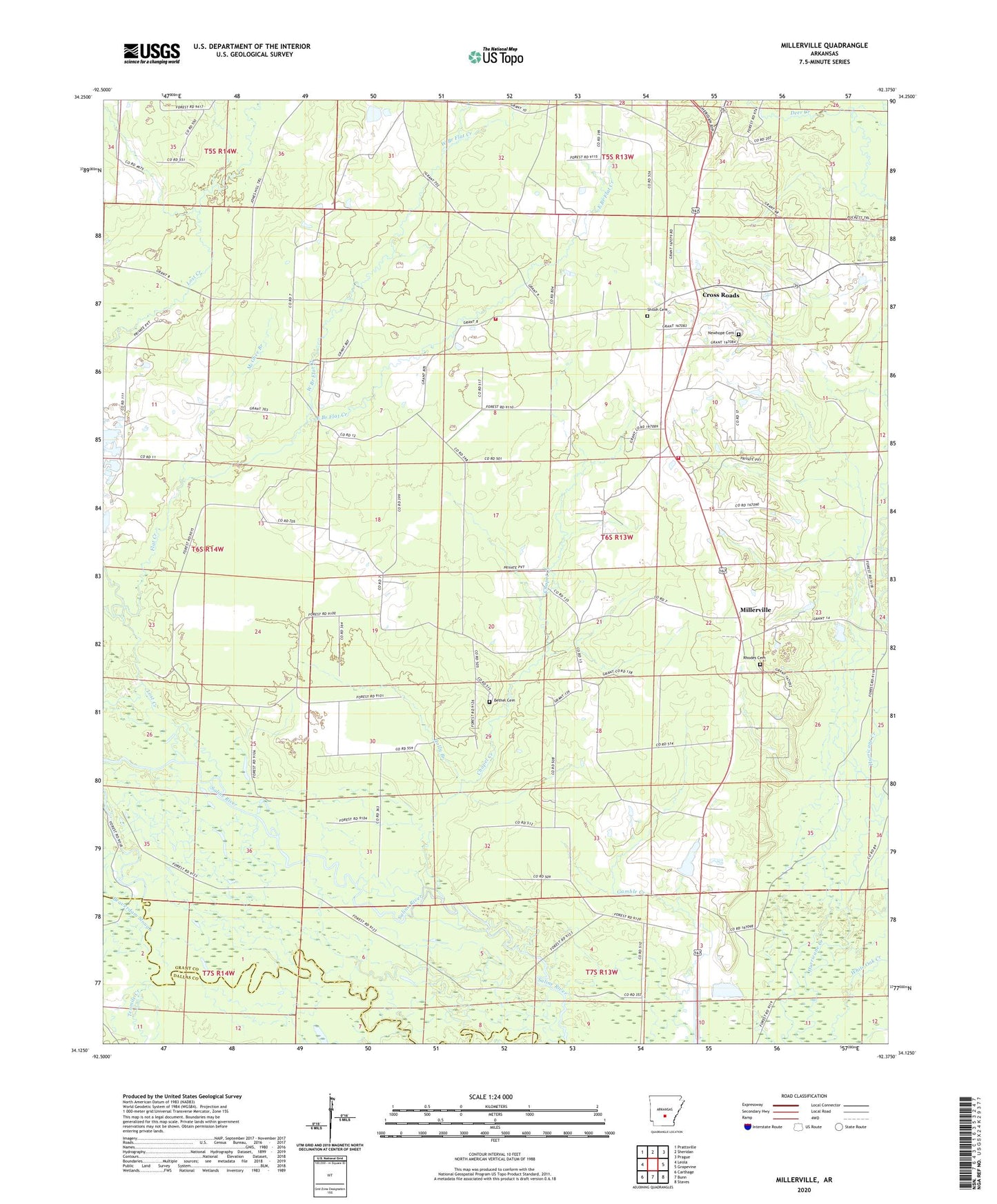
2024 topographic map quadrangle Millerville in the state of Arkansas. Scale: 1:24000. Based on the newly updated USGS 7.5' US Topo map series, this map is in the following counties: Grant, Dallas. The map contains contour data, water features, and other items you are used to seeing on USGS maps, but also has updated roads and other features. This is the next generation of topographic maps. Printed on high-quality waterproof paper with UV fade-resistant inks.
Quads adjacent to this one:
West: Leola
Northwest: Prattsville
North: Sheridan
Northeast: Prague
East: Grapevine
Southeast: Staves
South: Bunn
Southwest: Carthage
This map covers the same area as the classic USGS quad with code o34092b4.
Contains the following named places: Beaverdam Slough, Bethel Cemetery, Calvert Township Volunteer Fire Department, Calvert Township Volunteer Fire Station 2, Chapel Creek, Cross Roads, Deer Creek, East Branch Flat Creek, Flat Creek, Holly Branch, Lost Creek, McGhee Branch, Millerville, Newhope Cemetery, Rhodes Cemetery, Shiloh Cemetery, Shiloh Church, Tenmile Creek, Township of Calvert, West Branch Flat Creek