MyTopo
Princeton East Arkansas US Topo Map
Couldn't load pickup availability
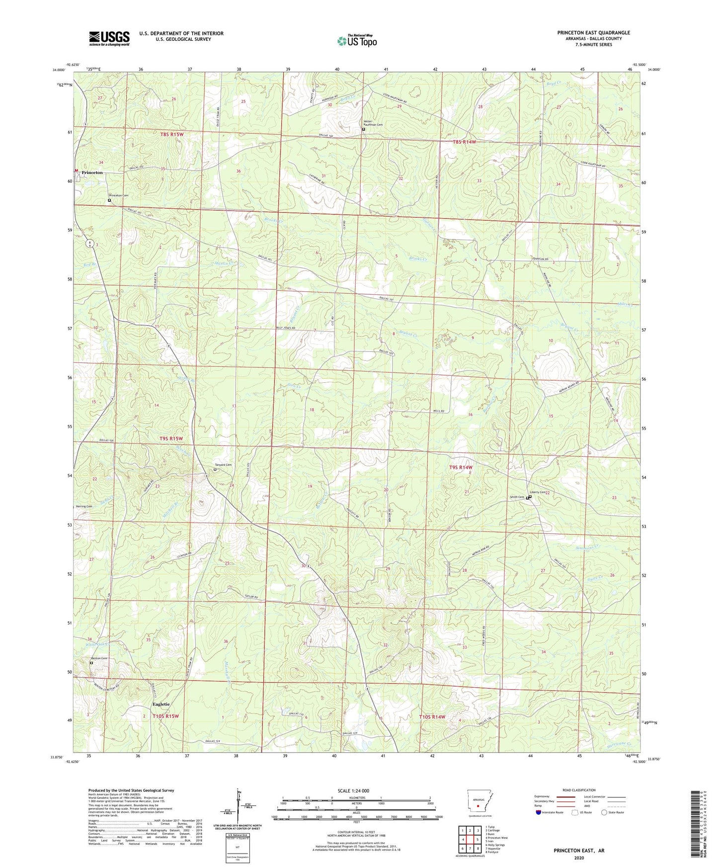
2024 topographic map quadrangle Princeton East in the state of Arkansas. Scale: 1:24000. Based on the newly updated USGS 7.5' US Topo map series, this map is in the following counties: Dallas. The map contains contour data, water features, and other items you are used to seeing on USGS maps, but also has updated roads and other features. This is the next generation of topographic maps. Printed on high-quality waterproof paper with UV fade-resistant inks.
Quads adjacent to this one:
West: Princeton West
Northwest: Tulip
North: Carthage
Northeast: Bunn
East: Ivan
Southeast: Fordyce
South: Hopeville
Southwest: Holly Springs
This map covers the same area as the classic USGS quad with code o33092h5.
Contains the following named places: Barlow Creek, Benton Cemetery, Beulah Church, Brooks Creek, Eagletie, Garner Creek, Liberty Cemetery, Princeton, Princeton Cemetery, Princeton Census Designated Place, Princeton Methodist Church, Saint Johns Church, Smith Cemetery, Stokes Branch, Tanyard Cemetery, Township of Liberty, Tulip - Princeton Fire Department, Vetter-Kauffman Cemetery, Zion Creek