MyTopo
Staves Arkansas US Topo Map
Couldn't load pickup availability
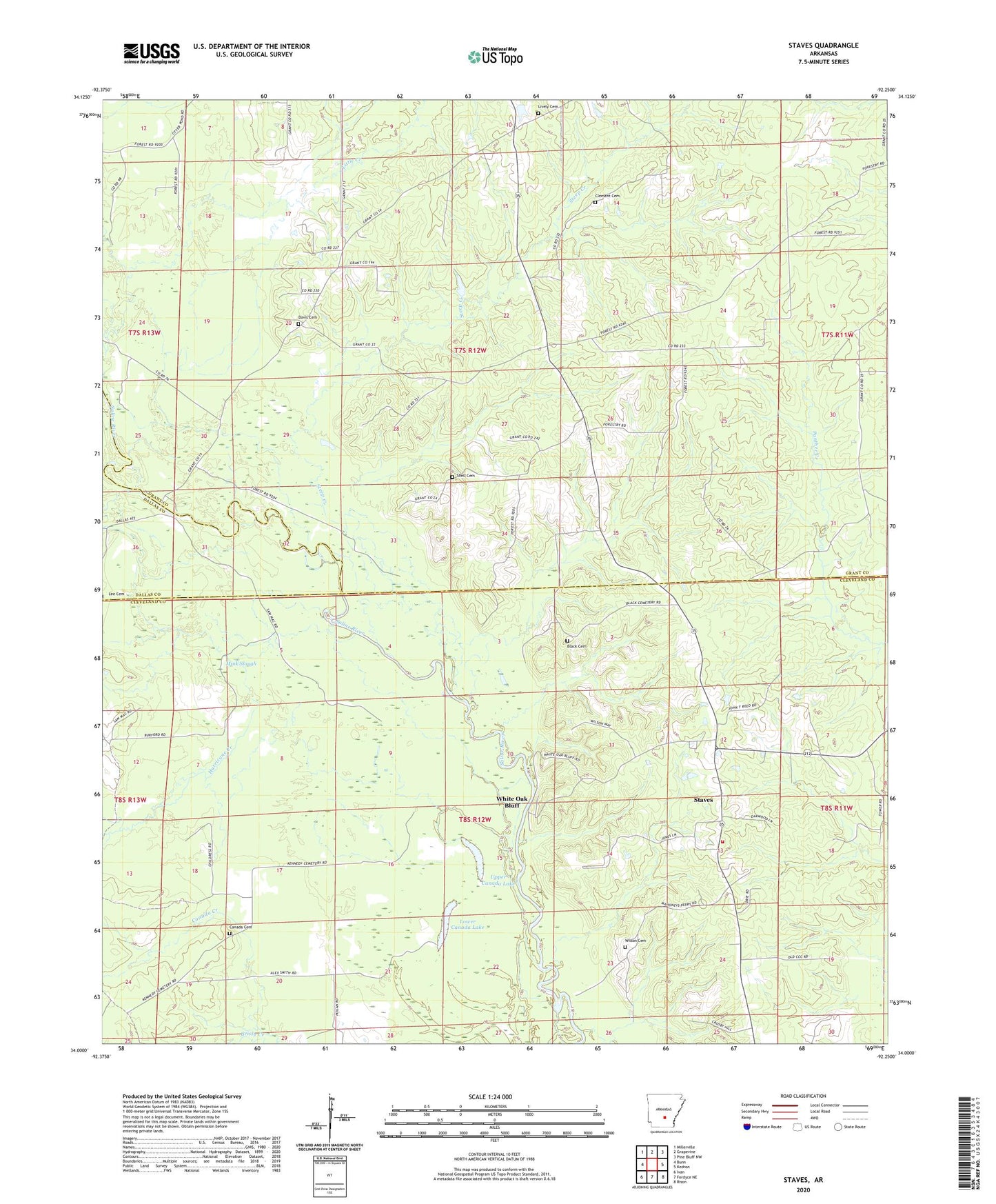
2024 topographic map quadrangle Staves in the state of Arkansas. Scale: 1:24000. Based on the newly updated USGS 7.5' US Topo map series, this map is in the following counties: Cleveland, Grant, Dallas. The map contains contour data, water features, and other items you are used to seeing on USGS maps, but also has updated roads and other features. This is the next generation of topographic maps. Printed on high-quality waterproof paper with UV fade-resistant inks.
Quads adjacent to this one:
West: Bunn
Northwest: Millerville
North: Grapevine
Northeast: Pine Bluff NW
East: Kedron
Southeast: Rison
South: Fordyce NE
Southwest: Ivan
This map covers the same area as the classic USGS quad with code o34092a3.
Contains the following named places: Amy Church, Barn Hill Creek, Bethany Church, Black Cemetery, Canada Cemetery, Canada Creek, Church of Christ, Clement Cemetery, Davis Cemetery, Fikes, Hurricane Creek, Lamont, Lees Ferry, Little Creek, Lively Cemetery, Lower Canada Lake, Mink Slough, Shady Grove Church, Shell Cemetery, Staves, Staves Census Designated Place, Steep Creek, Township of Madison, Township of White Oak, Upper Canada Lake, White Oak Bluff, Wilson Cemetery, Y Community Rural Fire Department Station 1