
MyTopo
Cass Arkansas US Topo Map
Couldn't load pickup availability
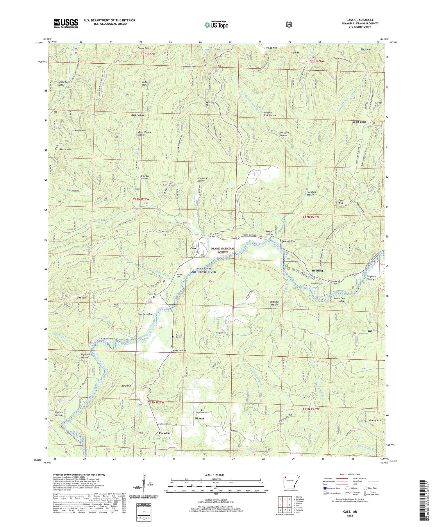
2024 topographic map quadrangle Cass in the state of Arkansas. Scale: 1:24000. Based on the newly updated USGS 7.5' US Topo map series, this map is in the following counties: Franklin. The map contains contour data, water features, and other items you are used to seeing on USGS maps, but also has updated roads and other features. This is the next generation of topographic maps. Printed on high-quality waterproof paper with UV fade-resistant inks.
Quads adjacent to this one:
West: Bidville
Northwest: Delaney
North: Saint Paul
Northeast: Pettigrew
East: Yale
Southeast: Hunt
South: Watalula
Southwest: Cravens
This map covers the same area as the classic USGS quad with code o35093f7.
Contains the following named places: Barnes, Barnes Volunteer Fire Department, Barron Creek, Bear Wallow Hollow, Bee Rock, Bee Rock Point of Interest, Bend Hill, Bend Hollow, Berry Chapel School, Big Eddy Hollow, Big Foot Branch, Big Foot Hollow, Bingham Hollow, Bowden Hollow, Browder Hollow, Buck Hollow, Camp Frazier, Camp Taft, Cass, Cass Job Corp Center, Cass Job Corps Center, Cherry Bend Recreation Area, Childers Cemetery, Cove Creek, Devils Den Hollow, Dick Hill Cemetery, East Fork Barron Creek, Eureka Springs Hollow, Fane Creek, Fisher Gap, Fly Gap, Fresno, Hanging Rock Hollow, Hornbeck Hollow, Hoyle Mountain, John Turner Creek, Left Prong Mountain Creek, Lindsey Branch, McBurrel Hollow, McIroy Cemetery, McMillan Hollow, Morgan Cemetery, Morgan Mountain, Mountain Creek, North Liberty School, Paradise, Parker Mountain, Perry Branch, Pinon Hollow, Plymale Cemetery, Redding, Redding Recreation Area, Right Prong Mountain Creek, Rock Creek, Shorty Hollow, Spy Rock, Spy Rock Hollow, Spy Rock Redding Loop, Township of Boston, Township of McIlroy, Township of Morgan, Turner Cemetery, Turners Bend, Turners Bend Cemetery, Wellcave Hollow, West Cobb, West Cobb School, West Prong Barron Creek


