MyTopo
Cravens Arkansas US Topo Map
Couldn't load pickup availability
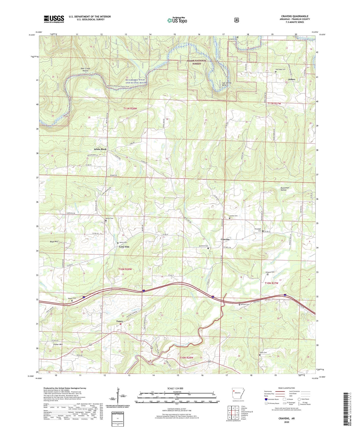
2024 topographic map quadrangle Cravens in the state of Arkansas. Scale: 1:24000. Based on the newly updated USGS 7.5' US Topo map series, this map is in the following counties: Franklin. The map contains contour data, water features, and other items you are used to seeing on USGS maps, but also has updated roads and other features. This is the next generation of topographic maps. Printed on high-quality waterproof paper with UV fade-resistant inks.
Quads adjacent to this one:
West: Mountainburg SE
Northwest: Fern
North: Bidville
Northeast: Cass
East: Watalula
Southeast: Ozark
South: Cecil
Southwest: Mulberry
This map covers the same area as the classic USGS quad with code o35093e8.
Contains the following named places: Bourland Cemetery, Boyd Mountain, Campbell Cemetery, Cedar Creek, Cravens, Cravens Church, Cravens Creek, Deer Creek Hollow, Dutchman Hollow, Fairview Church, Fisher Mountain, Franklin County, Ham Ford, Hamm Cemetery, Hixon Cemetery, Hurricane Creek, Jethro, Kings Ford, Lessley Cemetery, Lone Elm, Lone Elm Gas Field, Lone Oak School, Middle Ridge School, Oak Ridge Cemetery, Oak Ridge School, Pleasant View Elementary School, Pleasant View High School, Pleasant View Volunteer Fire Department, Possum Trot Creek, Rankin Cemetery, Salt Spring Bend, Threadgill Cemetery, Toney, Township of Cravens, Township of Mulberry, Township of Walker, Township of White Rock, Wagner Cemetery, White Oak Gas Field, White Rock, Whitson Cemetery, Williams Cemetery