MyTopo
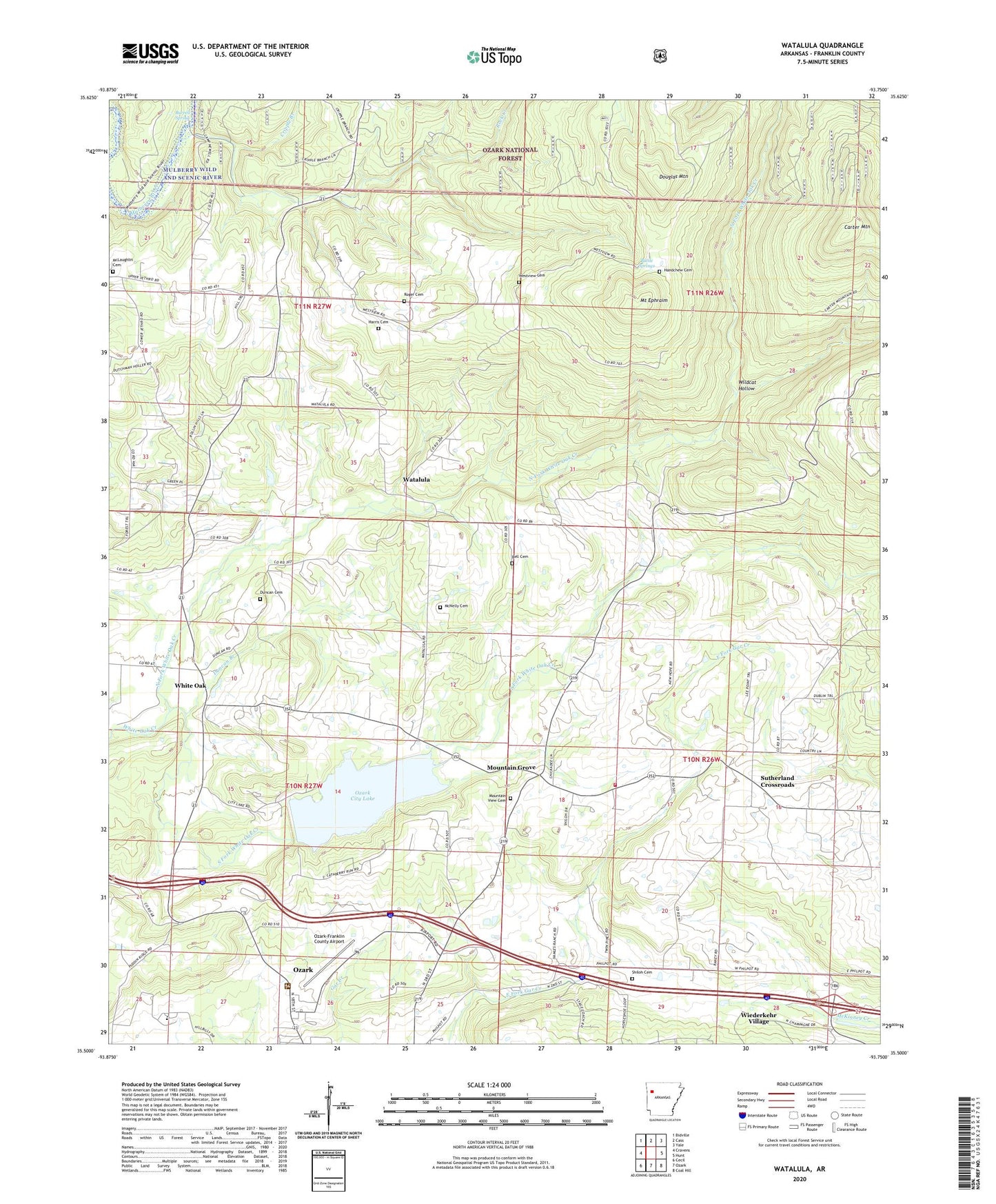
Watalula Arkansas US Topo Map
Couldn't load pickup availability
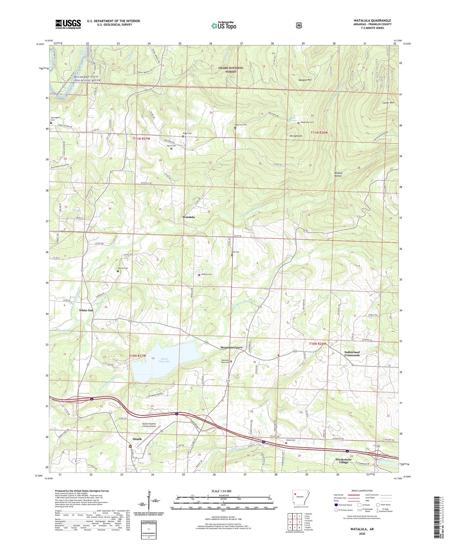
Also explore the Watalula Forest Service Topo of this same quad for updated USFS data
2024 topographic map quadrangle Watalula in the state of Arkansas. Scale: 1:24000. Based on the newly updated USGS 7.5' US Topo map series, this map is in the following counties: Franklin. The map contains contour data, water features, and other items you are used to seeing on USGS maps, but also has updated roads and other features. This is the next generation of topographic maps. Printed on high-quality waterproof paper with UV fade-resistant inks.
Quads adjacent to this one:
West: Cravens
Northwest: Bidville
North: Cass
Northeast: Yale
East: Hunt
Southeast: Coal Hill
South: Ozark
Southwest: Cecil
This map covers the same area as the classic USGS quad with code o35093e7.
Contains the following named places: Battle Springs, Bell Cemetery, Belt Chapel, Burrell Spring, Carter Mountain, Cripple Branch, Douglas Mountain, Duncan Branch, Duncan Cemetery, Enon Church, Felkner Town, Full Gospel Temple, Gar Creek Church, Handchew Cemetery, Harris Cemetery, Interstate 41, Jethro Church, Low Gap Church, McLaughlin Cemetery, McNelly Cemetery, Mount Ephraim, Mountain Grove, Mountain Top Church, Mountain View Cemetery, New Hope School, North Fork White Oak Creek, Ozark City Lake, Ozark High School, Ozark Water Supply Lake Dam, Ozark-Franklin County Airport, Pleasant Grove Church, Rock Creek Ford, Rock Creek Gas Field, Rogers Cemetery, Shiloh Cemetery, South Fork White Oak Creek, Sutherland Crossroads, Township of Watalula, Township of White Oak, Watalula, Watalula Fire Department, Westview Cemetery, Westview School, White Oak, White Oak Gas Field, Wildcat Hollow, ZIP Code: 72949