MyTopo
Hiwasse Arkansas US Topo Map
Couldn't load pickup availability
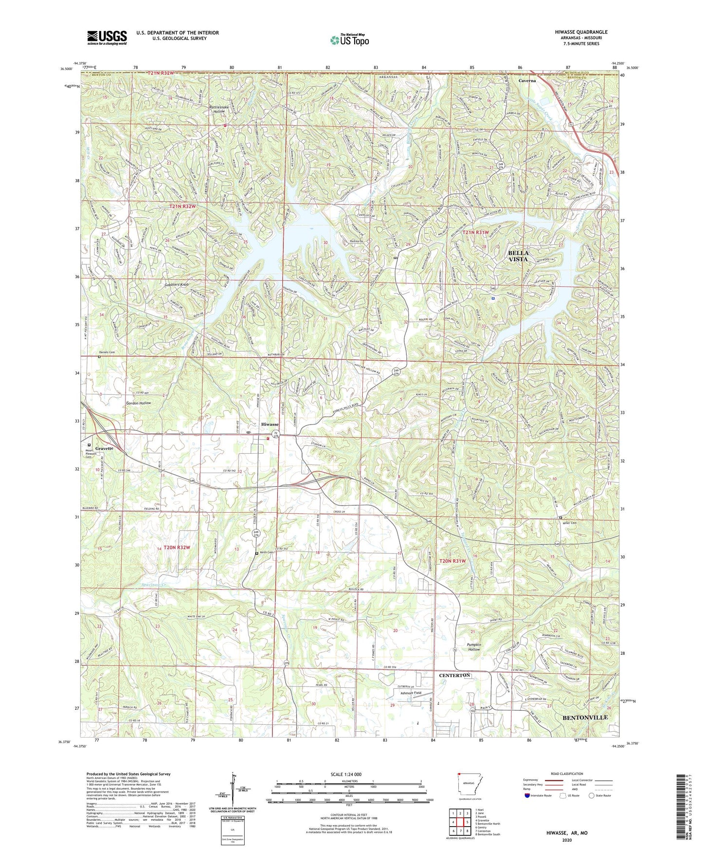
2024 topographic map quadrangle Hiwasse in the states of Arkansas, Missouri. Scale: 1:24000. Based on the newly updated USGS 7.5' US Topo map series, this map is in the following counties: Benton, McDonald. The map contains contour data, water features, and other items you are used to seeing on USGS maps, but also has updated roads and other features. This is the next generation of topographic maps. Printed on high-quality waterproof paper with UV fade-resistant inks.
Quads adjacent to this one:
West: Gravette
Northwest: Noel
North: Jane
Northeast: Powell
East: Bentonville North
Southeast: Bentonville South
South: Centerton
Southwest: Gentry
Contains the following named places: Ashmore Field, Banks School, Bella Vista, Bella Vista Country Club, Bella Vista Fire Department Station 3, Benton County Sheriff's Office Bella Vista Division, Bertschy Farms, Blackjack Church, Boling Farms, Calis, Caverna, Centerton Gamble Elementary School, City of Bella Vista, City of Gravette, Cross Lanes School, D and J Farms, Daniels Cemetery, Donivan School, Gobblers Knob, Hiwasse, Hiwasse Census Designated Place, Hiwasse Post Office, Hiwasse School, Hiwassee Fire Station, Keith Cemetery, Lake Avalon, Lake Avalon Dam, Lake Windsor, Lake Windsor Dam, Lynn Church of Christ, Miller, Miller Cemetery, Miller Church, Miller School, Mount Olive Church, Mount Pleasant Cemetery, Mount Pleasant Missionary Baptist Church, Pleasant Hill School, Race, Rocky Comfort, Rocky Comfort Church, Rocky Comfort School, Tanyard Creek, The Highlands Post Office, Township 10, Township of Dickson, Township of Garland, Zion Rest Baptist Church, ZIP Codes: 72715, 72739