MyTopo
Sulphur Rock Arkansas US Topo Map
Couldn't load pickup availability
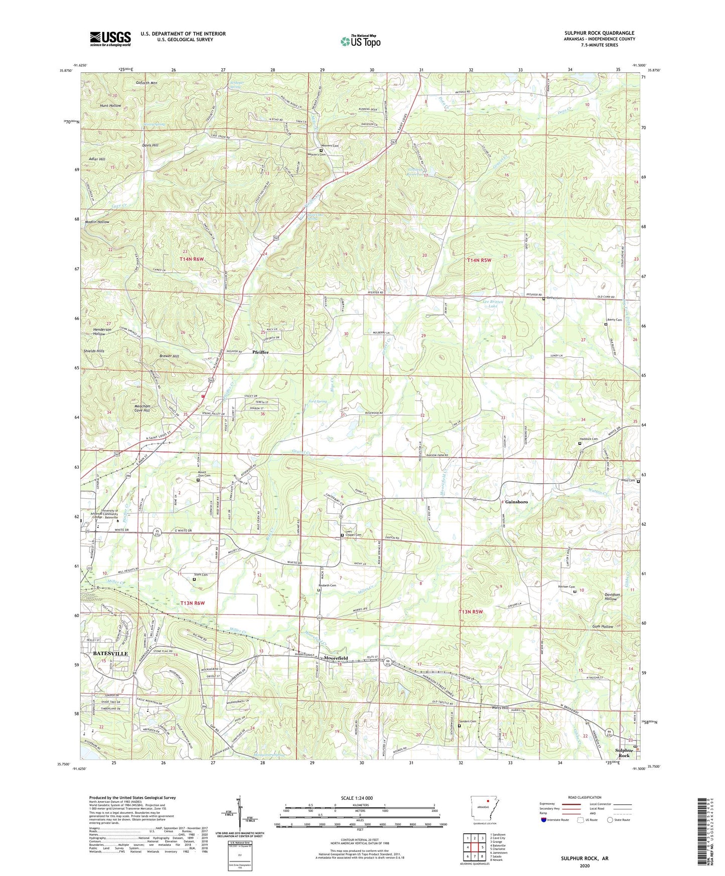
2024 topographic map quadrangle Sulphur Rock in the state of Arkansas. Scale: 1:24000. Based on the newly updated USGS 7.5' US Topo map series, this map is in the following counties: Independence. The map contains contour data, water features, and other items you are used to seeing on USGS maps, but also has updated roads and other features. This is the next generation of topographic maps. Printed on high-quality waterproof paper with UV fade-resistant inks.
Quads adjacent to this one:
West: Batesville
Northwest: Sandtown
North: Cave City
Northeast: Grange
East: Charlotte
Southeast: Newark
South: Salado
Southwest: Jamestown
This map covers the same area as the classic USGS quad with code o35091g5.
Contains the following named places: Adler Hill, Balch Addition, Bales Mine, Batesville High School, Batesville Junior High School, Batesville Senior High School, Bethel Cemetery, Blue Creek, Brewer Hill, Brewer School, Bryant Woodland Heights, Cave Creek Church, Cave Creek Church of God, Center Hall School, Christian Golden Rule Church, City of Batesville, College Heights Addition, Cooper Cane Creek, Corinth Church of God, Davidson Hollow, Davis Hill, Deer Lick Woods, Dunegan Prospect, Eagle Mountain Elementary School, East Batesville Freewill Baptist Church, Eastwood Addition, Ford Spring, Full Gospel Fellowship Church, G A Wilson Mine, Gainsboro, Gateway Vocational-Technical School, Goforth Lake Dam, Goforth Mountain, Goforth Reservoir, Gravel Creek, Gum Hollow, Haddock Cemetery, Harvison Cemetery, Henley Mine, Hope Lutheran Church, Hunt Hollow Mine, J A Reves Mine, Lake Kimberly Dam, Lee Britten Lake, Lee Britten Lake Dam, Lees Chapel Cemetery, Liberty Cemetery, Liberty Church, Lyon College, M W Reves Prospect, Matheny Mine, Meacham Cave Hill, Miller Creek, Modlin Hollow, Montgomery Spring, Moorefield, Moorefield Creek, Mount Zion Cemetery, Moyer Mine, New Hope School, Northside Fire Department, O'Flinn Prospect, Ozark Mine, Pfeiffer, Pfeiffer Creek, Pfeiffer Junction, Pfeiffer School, Pleasant Valley Missionary Baptist Church, Quail Valley, R L Knies Lake, R L Knies Lake Dam, Reed School, Rehobeth Baptist Church, Reobeth Cemetery, Rogers Addition, Saint Clair Spring, Sanders Cemetery, Schlieper Mine, Schlieper Spring, Searcy Mine, Searcy Spring, Sharp, Sharp United Methodist Church, Silberstein Prospect, Stark Cemetery, Sulphur Rock, Sulphur Rock Post Office, The Alter Call Church, Town of Moorefield, Town of Sulphur Rock, Township of Gainsboro, Township of Moorefield, Waits Hill, Walbert Mine, Watson Creek, Weavers Cemetery, Weaver's Cemetery, Weavers Chapel, Wolford Addition, Wood Cemetery, Woodland Nursing Home