MyTopo
Salado Arkansas US Topo Map
Couldn't load pickup availability
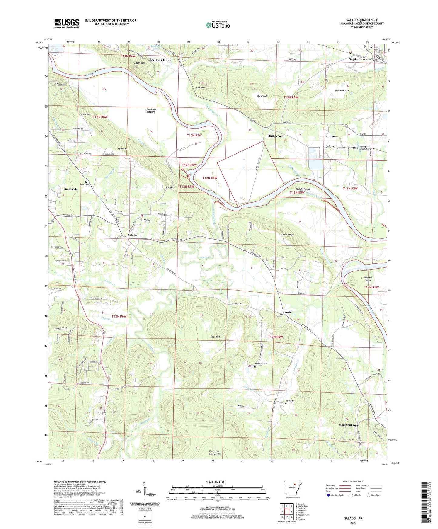
2024 topographic map quadrangle Salado in the state of Arkansas. Scale: 1:24000. Based on the newly updated USGS 7.5' US Topo map series, this map is in the following counties: Independence. The map contains contour data, water features, and other items you are used to seeing on USGS maps, but also has updated roads and other features. This is the next generation of topographic maps. Printed on high-quality waterproof paper with UV fade-resistant inks.
Quads adjacent to this one:
West: Jamestown
Northwest: Batesville
North: Sulphur Rock
Northeast: Charlotte
East: Newark
Southeast: Olyphant
South: Huff
Southwest: Pleasant Plains
This map covers the same area as the classic USGS quad with code o35091f5.
Contains the following named places: Allen Hill, Arkansas Eastman Company, Big Creek, Bill Hill, Caldwell Mountain, Caney Creek, Cedar Creek, Dennison Bottoms, Eagle Mountain, Egner Cemetery, Egner Hill, Fallen Ash Creek, Goodie Creek, Independence County, Kyler Creek, Ladd Branch, Macedonia Cemetery, Magness Ferry, Maple Springs, Mount Zion Church, Neal Mountain, Old River, Pine Mountain, Possum Creek, Powers Creek, Qualls Mountain, Rosie, Rosie Baptist Church, Rosie Post Office, Rutherford, Rutherford Creek, Salado, Salado Census Designated Place, Salado Creek, Salado Post Office, Southside, Southside Elementary School, Southside Fire Department Station 2, Sulphur Rock Cemetery, Swaims Chapel, Township of Huff, Township of Rosie, Township of Salado, Township of White River, Tucker Ridge, Waldrip Branch, Wright Cutoff, Wright Island, Wyatt Cemetery, Wycough Branch, ZIP Code: 72571