MyTopo
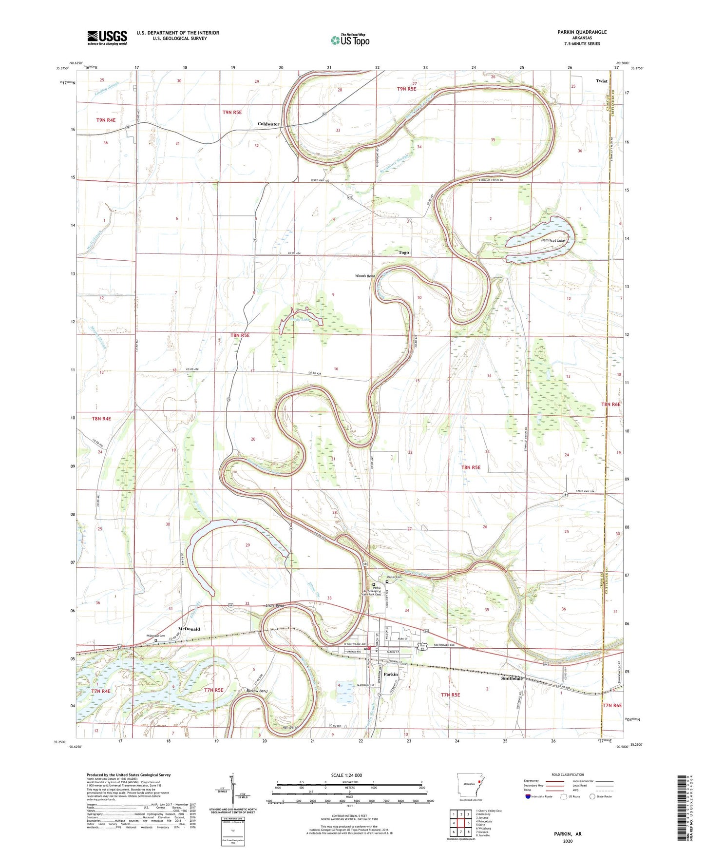
Parkin Arkansas US Topo Map
Couldn't load pickup availability
2024 topographic map quadrangle Parkin in the state of Arkansas. Scale: 1:24000. Based on the newly updated USGS 7.5' US Topo map series, this map is in the following counties: Cross, Crittenden. The map contains contour data, water features, and other items you are used to seeing on USGS maps, but also has updated roads and other features. This is the next generation of topographic maps. Printed on high-quality waterproof paper with UV fade-resistant inks.
Quads adjacent to this one:
West: Princedale
Northwest: Cherry Valley East
North: Monterey
Northeast: Joyland
East: Earle
Southeast: Jeanette
South: Gieseck
Southwest: Wittsburg
This map covers the same area as the classic USGS quad with code o35090c5.
Contains the following named places: Ash Bend, Barnes Lake, Barrow Bend, Belknap, Burr Place, Burr School, City of Parkin, Coldwater, Coldwater School, Colton Crossing, Dunn, Egypt Church, Love Place, Macedonia Church, McDonald, McDonald Cemetery, McDonald Church, Merck, Mount Olive Church, Mount Zion Church, Old Neelys Ferry, Parkin, Parkin Archeological State Park Cemetery, Parkin Cemetery, Parkin Elementary School, Parkin High School, Parkin Mound Archeological State Park, Parkin Police Department, Parkin Post Office, Parkin Volunteer Fire Department, Pemiscot Lake, Saint Francis, Shady Grove Church, Short Bend, Smithdale, Swan Lake, Sycamore Slough, Togo, Togo Baptist Church, Tyronza River, Woods Bend, Yarbo Place, ZIP Code: 72373