MyTopo
Clarendon Arkansas US Topo Map
Couldn't load pickup availability
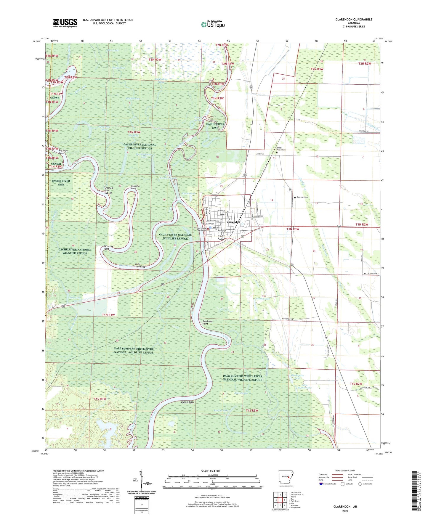
2024 topographic map quadrangle Clarendon in the state of Arkansas. Scale: 1:24000. Based on the newly updated USGS 7.5' US Topo map series, this map is in the following counties: Monroe, Prairie. The map contains contour data, water features, and other items you are used to seeing on USGS maps, but also has updated roads and other features. This is the next generation of topographic maps. Printed on high-quality waterproof paper with UV fade-resistant inks.
Quads adjacent to this one:
West: Roe
Northwest: De Valls Bluff
North: De Valls Bluff SE
Northeast: Keevil
East: Park Grove
Southeast: Holly Grove
South: Aberdeen
Southwest: Ulm
This map covers the same area as the classic USGS quad with code o34091f3.
Contains the following named places: 1st Judicial District Drug Task Force, Bateman Cemetery, Bear Slough, Bethlehem Church, Big Baptize Lake, Big Eddy Point, Big Weidmann Lake, Brushy Lake, Burma, Cache River, Cache River National Wildlife Refuge, City of Clarendon, Clarendon, Clarendon Elementary School, Clarendon High School, Clarendon Police Department, Clarendon Post Office, Clarendon Volunteer Fire Department, Crooked Point Cut-off, Dead Man Point, East Bayou, First Old River, Fish Slough, Franklin Point, Grove Church, Hart Lake, Hole in the Wall, Holly Tree Bend, Jeffries, Lenoir, Little Baptize Lake, Little Weidmann Lake, Middle Old River, Middle Prong, Midway Lake, Midway Lake Dam, Monroe County Sheriff's Office, Otter Lake, Passmore Lake, Philadelphia Church, Ramsey Mill Site, Red Cat Lake, Right Hand Prong, Round Pond, Shady Grove Cemetery, Sycamore Point, The Horn, Township of Cache, Upper Old River, Walnut Ridge