MyTopo
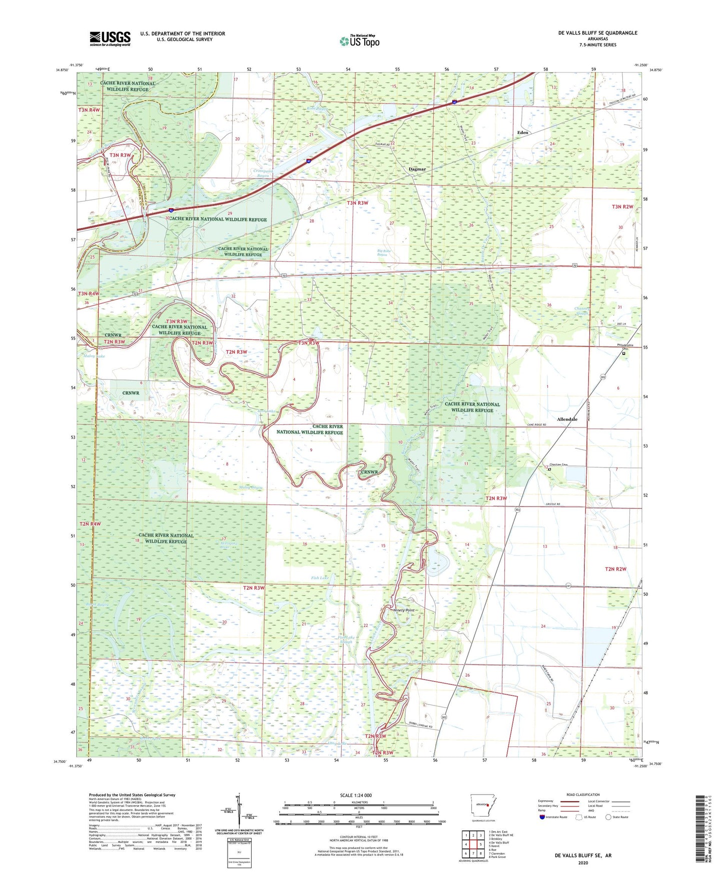
De Valls Bluff SE Arkansas US Topo Map
Couldn't load pickup availability
2024 topographic map quadrangle De Valls Bluff SE in the state of Arkansas. Scale: 1:24000. Based on the newly updated USGS 7.5' US Topo map series, this map is in the following counties: Monroe, Prairie. The map contains contour data, water features, and other items you are used to seeing on USGS maps, but also has updated roads and other features. This is the next generation of topographic maps. Printed on high-quality waterproof paper with UV fade-resistant inks.
Quads adjacent to this one:
West: De Valls Bluff
Northwest: Des Arc East
North: De Valls Bluff NE
Northeast: Brinkley
East: Keevil
Southeast: Park Grove
South: Clarendon
Southwest: Roe
This map covers the same area as the classic USGS quad with code o34091g3.
Contains the following named places: Allendale, Bayou De View, Big Robe Bayou, Channey Slough, Choctaw Cemetery, Crosspond Bayou, Dagmar, Dobbs Landing, Eden, Fish Lake, Fish Lake Slough, Goose Lake, Horseshoe Lake, Ingram Lake, Jackson Bayou, Jones Island, Little Robe Bayou, Long Lake, Lost Lake, Maloy Bayou, Maloy Lake, McFarland Brake, Ninety Point, Philadelphia Cemetery, Philadelphia Church, Rainbow Lake, Reeses Fork, Sevenmile Bayou, Straight Lake, Township of Brown