MyTopo
Ulm Arkansas US Topo Map
Couldn't load pickup availability
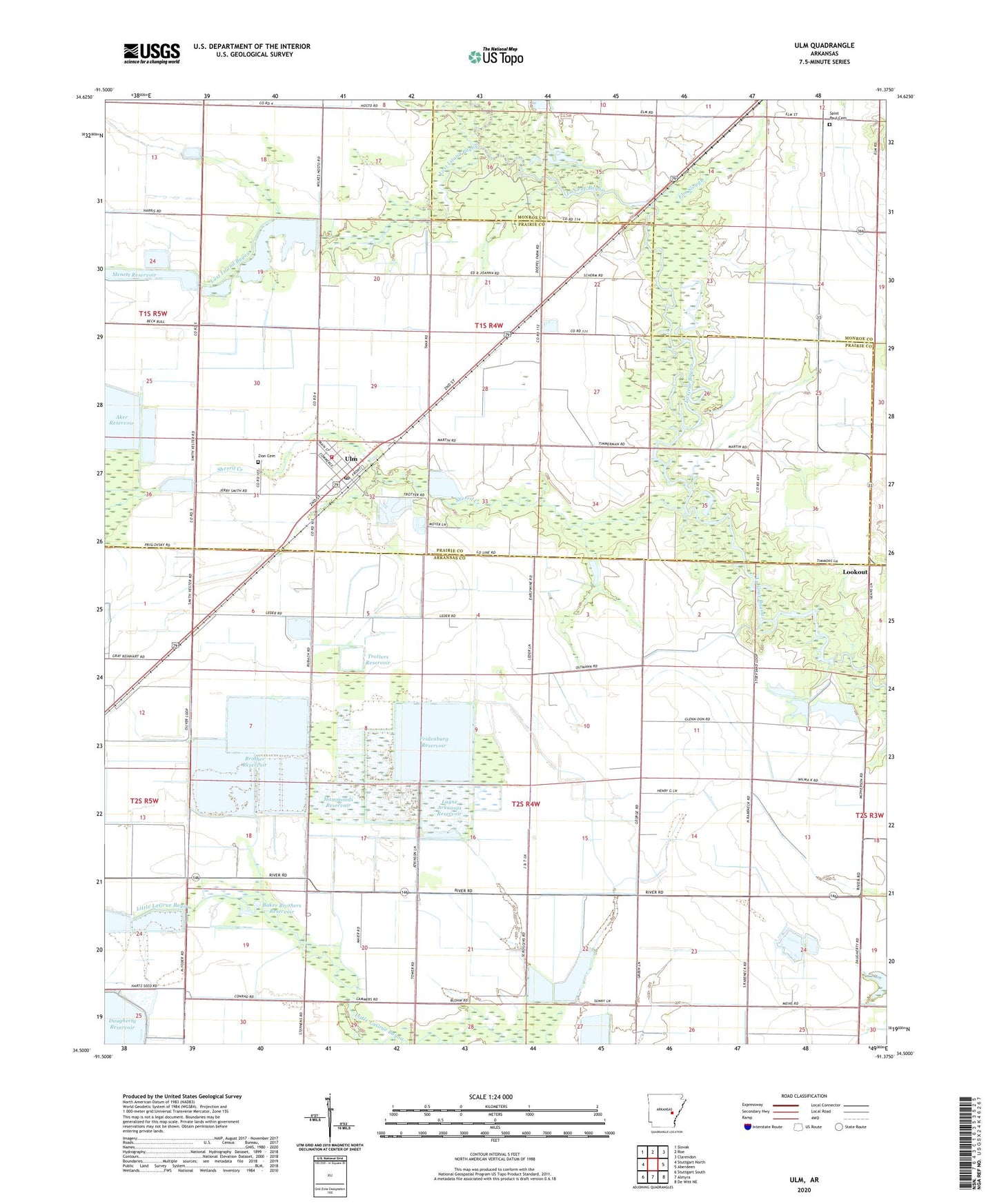
2024 topographic map quadrangle Ulm in the state of Arkansas. Scale: 1:24000. Based on the newly updated USGS 7.5' US Topo map series, this map is in the following counties: Arkansas, Prairie, Monroe. The map contains contour data, water features, and other items you are used to seeing on USGS maps, but also has updated roads and other features. This is the next generation of topographic maps. Printed on high-quality waterproof paper with UV fade-resistant inks.
Quads adjacent to this one:
West: Stuttgart North
Northwest: Slovak
North: Roe
Northeast: Clarendon
East: Aberdeen
Southeast: De Witt NE
South: Almyra
Southwest: Stuttgart South
This map covers the same area as the classic USGS quad with code o34091e4.
Contains the following named places: Aker Reservoir, Audrich Switch, Baker Brothers Reservoir, Bardill, Brother Reservoir, Daugherty Reservoir, Elm Slough, Fridenburg Reservoir, Hammonds Reservoir, KXRC-FM (Clarendon), Lambert Reservoir, Layne Arkansas Reservoir, Lookout, Lost Island Bayou, McCollum Lake Dam, Menett Reservoir, Saint Paul Cemetery, Saint Paul Church, Scroggins Reservoir, Sherril Creek, Stanley School, Town of Ulm, Township of McFall, Trotters Reservoir, Ulm, Ulm Fire Department, Ulm Post Office, Zion Cemetery, ZIP Code: 72170