MyTopo
Keevil Arkansas US Topo Map
Couldn't load pickup availability
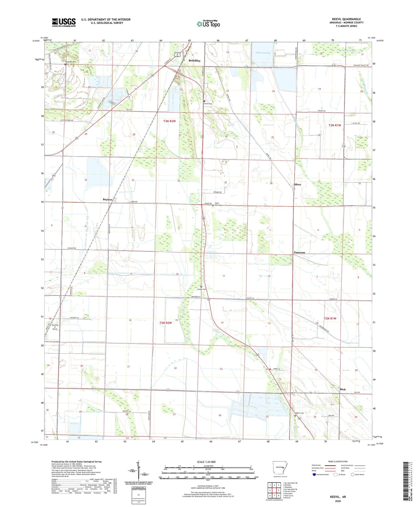
2024 topographic map quadrangle Keevil in the state of Arkansas. Scale: 1:24000. Based on the newly updated USGS 7.5' US Topo map series, this map is in the following counties: Monroe. The map contains contour data, water features, and other items you are used to seeing on USGS maps, but also has updated roads and other features. This is the next generation of topographic maps. Printed on high-quality waterproof paper with UV fade-resistant inks.
Quads adjacent to this one:
West: De Valls Bluff SE
Northwest: De Valls Bluff NE
North: Brinkley
Northeast: Wheatley
East: Garrett Grove
Southeast: Monroe
South: Park Grove
Southwest: Clarendon
This map covers the same area as the classic USGS quad with code o34091g2.
Contains the following named places: Alfrey, Bayless, Brinkley Country Club, Dunn's Fish Farm, East Monroe County Rural Fire Department Station 1, Emmons, Finell Cemetery, Fitzhugh Cemetery, Jeffries Church, Jordan Cemetery, KBRI-AM (Brinkley), Keevil, KQMC-FM (Brinkley), Lake Greenlee, Lake Greenlee Reservoir, Lake Greenlee Reservoir Dam, Maple Slough, Mount Canaan Church, New Hope Church, New Hope School, Oak Grove Church, Rich, Saint John Cemetery, Saint Johns Missionary Baptist Church, Stoops, Township of Brinkley, Township of Cypress Ridge, Township of Dixon, Township of Keevil, Upper Cemetery, ZIP Code: 72021