MyTopo
Cotton Plant Arkansas US Topo Map
Couldn't load pickup availability
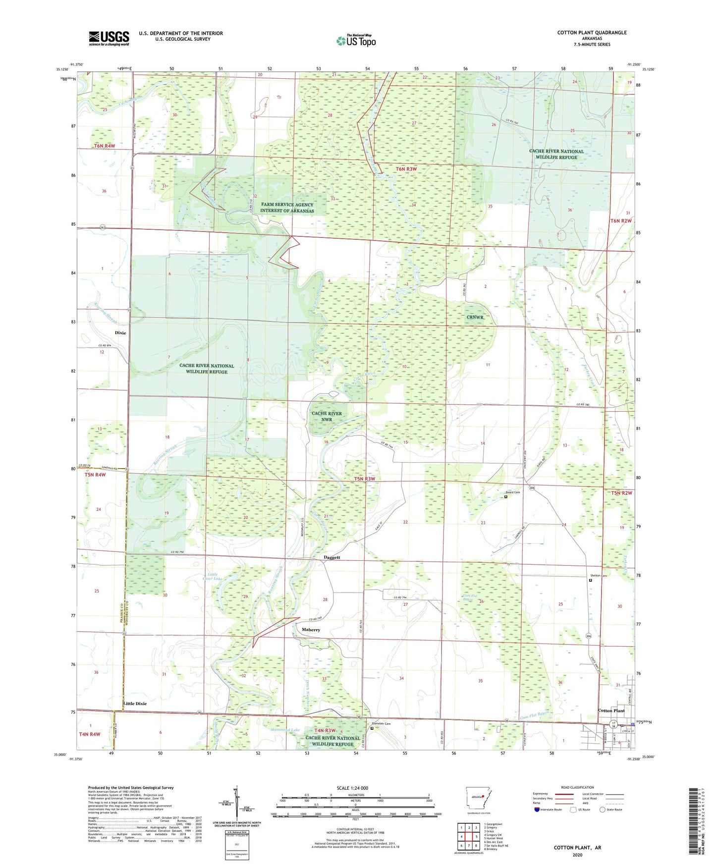
2024 topographic map quadrangle Cotton Plant in the state of Arkansas. Scale: 1:24000. Based on the newly updated USGS 7.5' US Topo map series, this map is in the following counties: Woodruff, Prairie. The map contains contour data, water features, and other items you are used to seeing on USGS maps, but also has updated roads and other features. This is the next generation of topographic maps. Printed on high-quality waterproof paper with UV fade-resistant inks.
Quads adjacent to this one:
West: Gregory SW
Northwest: Georgetown
North: Gregory
Northeast: Grays
East: Hunter West
Southeast: Brinkley
South: De Valls Bluff NE
Southwest: Des Arc East
This map covers the same area as the classic USGS quad with code o35091a3.
Contains the following named places: Beard Cemetery, Cache Bayou, City of Cotton Plant, Cotton Plant, Cotton Plant Elementary School, Cotton Plant High School, Cotton Plant Police Department, Cotton Plant Post Office, Cow Mound, Daggett, Dixie, Ebenezer Cemetery, Gum Flat Bayou, James Ferry, Little Clear Lake, Little Dixie, Maberry, Overholt Landing Strip, Pleasant Grove Church, Roaring Slough, Rock Chapel, Shady Grove, Shady Grove Church, Shelton Cemetery, Township of Cotton Plant, United States Fish and Wildlife Cache River National Wildlife Refuge Park Security, ZIP Code: 72036