MyTopo
De Valls Bluff NE Arkansas US Topo Map
Couldn't load pickup availability
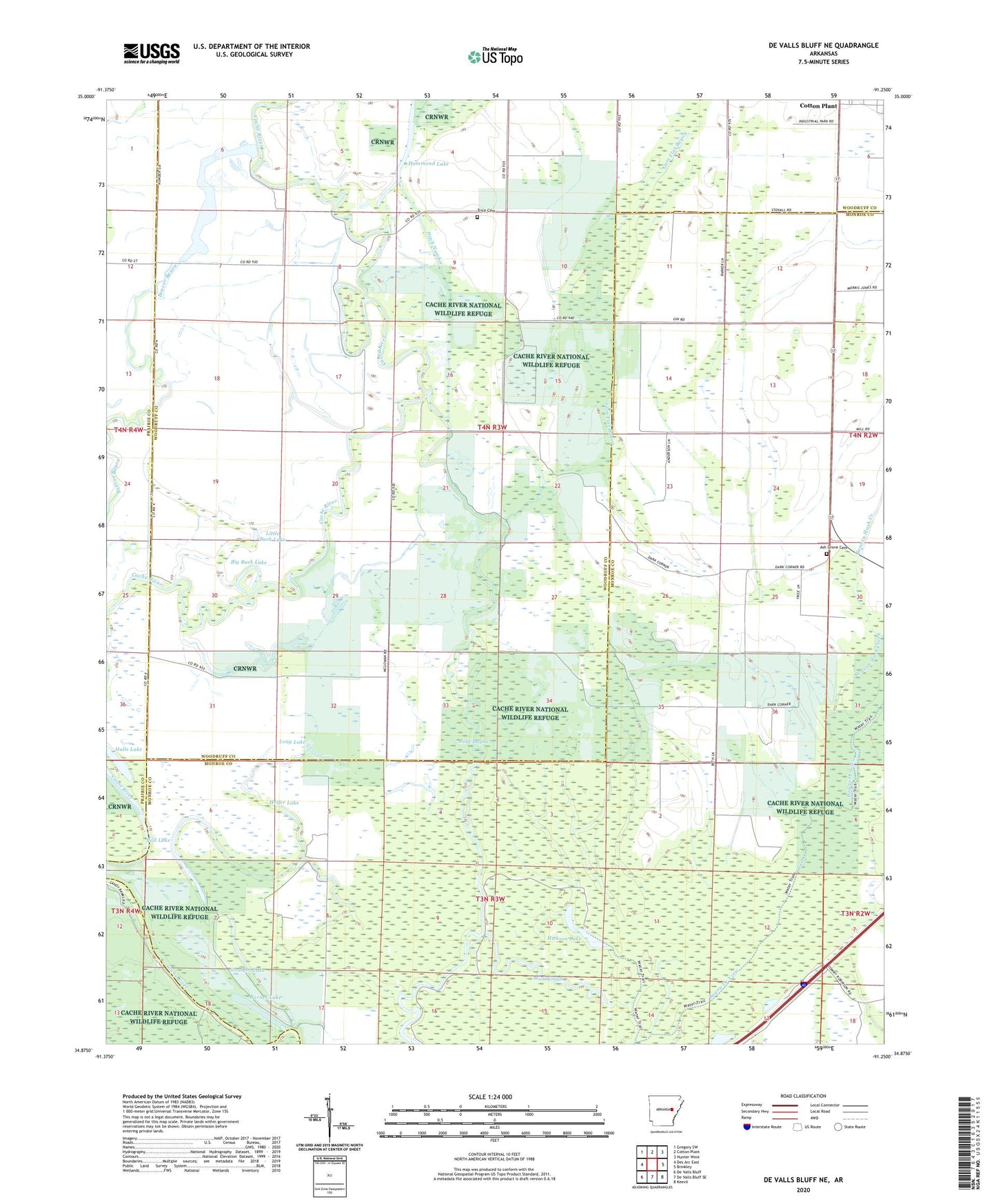
2024 topographic map quadrangle De Valls Bluff NE in the state of Arkansas. Scale: 1:24000. Based on the newly updated USGS 7.5' US Topo map series, this map is in the following counties: Woodruff, Monroe, Prairie. The map contains contour data, water features, and other items you are used to seeing on USGS maps, but also has updated roads and other features. This is the next generation of topographic maps. Printed on high-quality waterproof paper with UV fade-resistant inks.
Quads adjacent to this one:
West: Des Arc East
Northwest: Gregory SW
North: Cotton Plant
Northeast: Hunter West
East: Brinkley
Southeast: Keevil
South: De Valls Bluff SE
Southwest: De Valls Bluff
This map covers the same area as the classic USGS quad with code o34091h3.
Contains the following named places: Ash Grove Cemetery, Ash Grove Church, Barnes Lake, Benson Slash Creek, Big Buck Lake, Bull Lake, Dagmar State Wildlife Management Area, Ditch Number 1, Gum Flat Bayou, Halls Lake, Hammond Lake, Heifer Lake, Hickson Lake, Little Buck Lake, Long Lake, Mount Pleasant Church, Mount Pleasant School, Mud Slough, New Home Church, Olive Branch Church, Robe Bayou, Straight Lake, Township of Freeman, Trice Cemetery, Trices Chapel