MyTopo
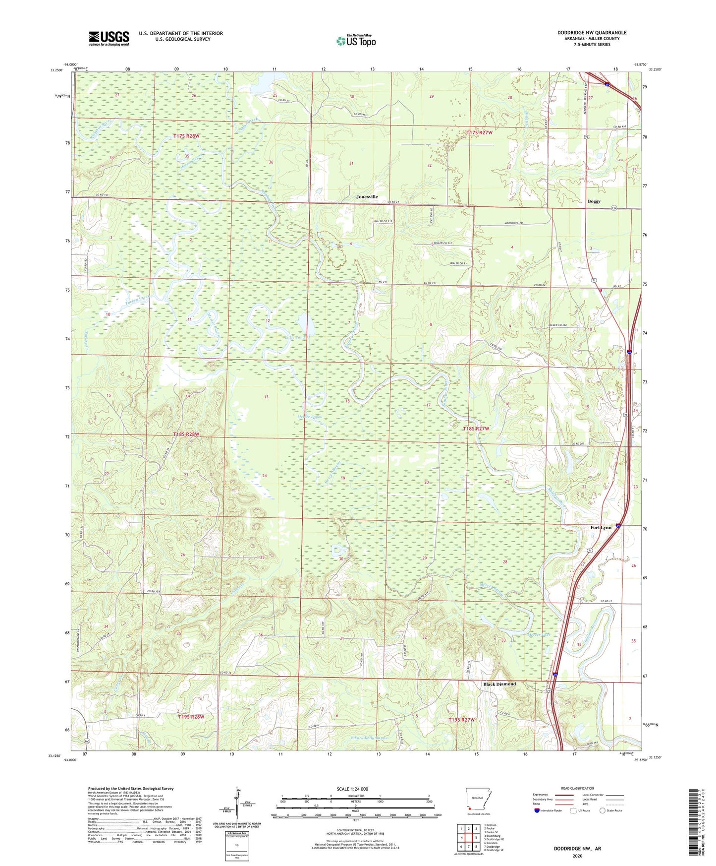
Doddridge NW Arkansas US Topo Map
Couldn't load pickup availability
2024 topographic map quadrangle Doddridge NW in the state of Arkansas. Scale: 1:24000. Based on the newly updated USGS 7.5' US Topo map series, this map is in the following counties: Miller. The map contains contour data, water features, and other items you are used to seeing on USGS maps, but also has updated roads and other features. This is the next generation of topographic maps. Printed on high-quality waterproof paper with UV fade-resistant inks.
Quads adjacent to this one:
West: Bloomburg
Northwest: Domino
North: Fouke
Northeast: Fouke SE
East: Doddridge NE
Southeast: Doddridge SE
South: Doddridge
Southwest: Ravanna
This map covers the same area as the classic USGS quad with code o33093b8.
Contains the following named places: Antioch Church, Black Diamond, Boggy, Boggy Creek Volunteer Fire Department, Caney Church, Caney Creek, Crabtree Lake, Crabtree Lake Dam, Days Creek, Fort Lynn, Jonesville, Kennedy Lake, Little Pond, Mercer Bayou, Mercer Lake, Millett Oil and Gas Field, Springhill Church, Sulphur River Lookout Tower, Sulphur River State Wildlife Management Area, Township of Beech, Turkey Creek