MyTopo
Domino Texas US Topo Map
Couldn't load pickup availability
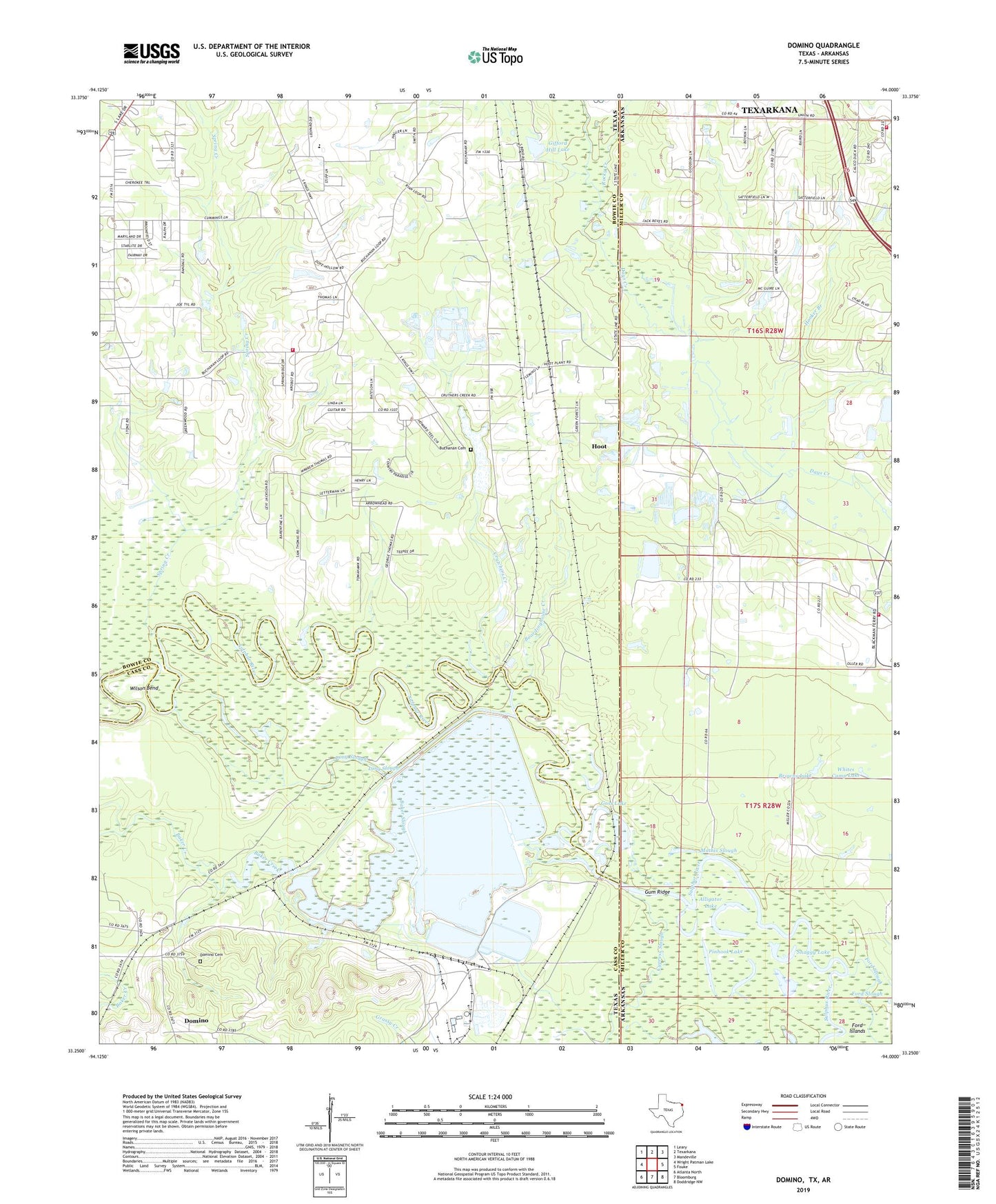
2022 topographic map quadrangle Domino in the states of Texas, Arkansas. Scale: 1:24000. Based on the newly updated USGS 7.5' US Topo map series, this map is in the following counties: Bowie, Miller, Cass. The map contains contour data, water features, and other items you are used to seeing on USGS maps, but also has updated roads and other features. This is the next generation of topographic maps. Printed on high-quality waterproof paper with UV fade-resistant inks.
Quads adjacent to this one:
West: Wright Patman Lake
Northwest: Leary
North: Texarkana
Northeast: Mandeville
East: Fouke
Southeast: Doddridge NW
South: Bloomburg
Southwest: Atlanta North
This map covers the same area as the classic USGS quad with code o33094c1.
Contains the following named places: Alligator Lake, Apostolic Heritage Church, Baker Creek, Baker Slough, Boardinghouse Creek, Bright Star Church, Browns Lake, Buchanan Cemetery, Buchanan First Baptist Church, Buchanan Memorial Church, Canaan Land Church, Crutchers Creek, Cypress Slough, Domino, Domino Cemetery, Elliott Slough, Ford Islands, Ford Slough, Free Oneness Church, Friendship Church, Gifford Hill Dam, Gifford Hill Gravel Pit, Gifford Hill Lake, Goss Lake, Gum Ridge, Harmony Grove Church, Hooker Branch, Hoot, Kennedy Dam, Kennedy Lake, Liberty - Eylau Volunteer Fire Department Station 2, Lick Branch, Line Ferry, Long Slough, Mathis Slough, Moes Slough, Pinhook Lake, Pleasant Hill, Pleasant Hill Church, Pleasant Hill Fire Department, Rocky Creek, Saint Paul Church, Snaggy Lake, Spring Creek, Sulphur, Trinity Volunteer Fire Department, Whites Camp Lake, Wilson Bend