MyTopo
Bloomburg Texas US Topo Map
Couldn't load pickup availability
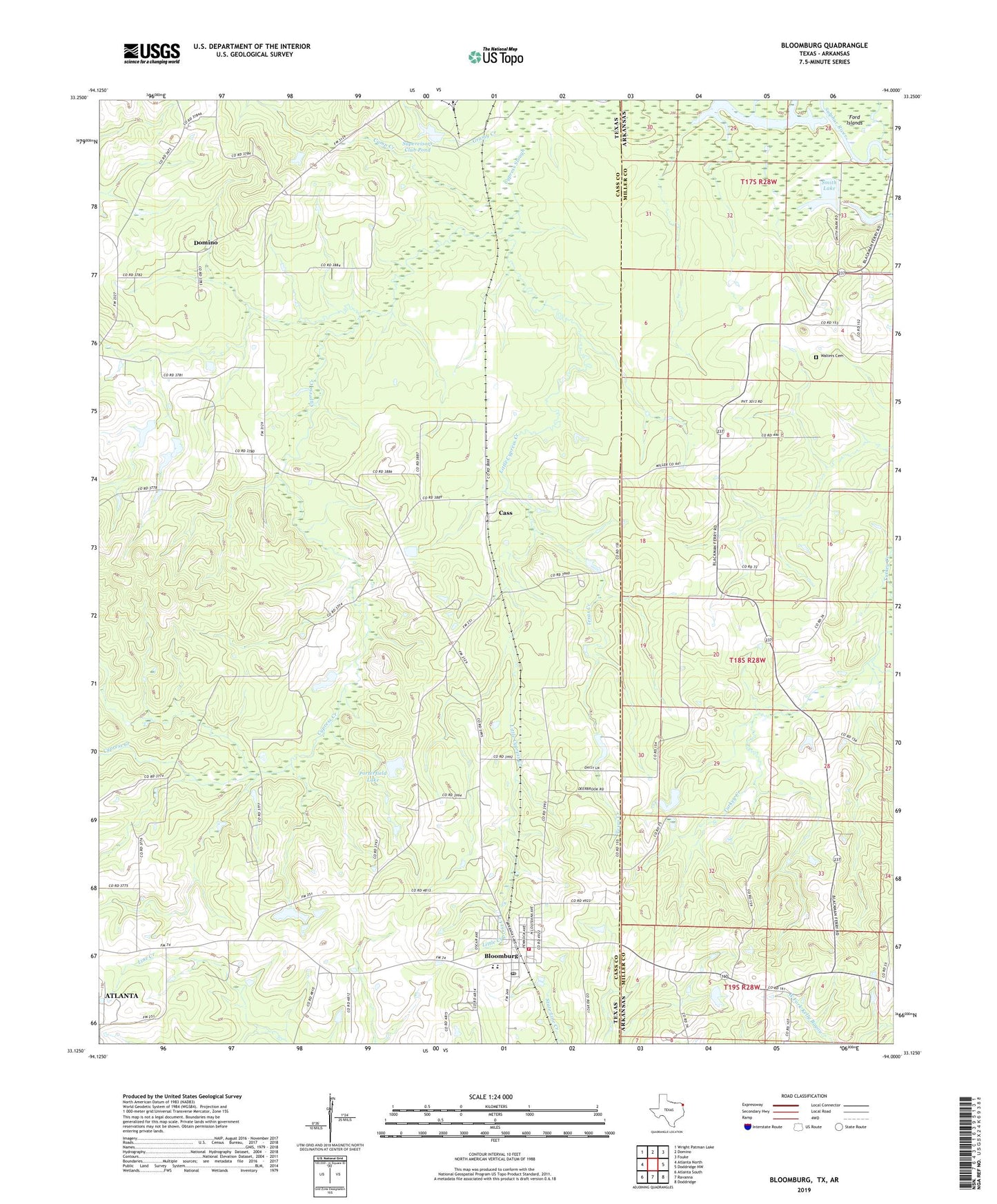
2022 topographic map quadrangle Bloomburg in the states of Texas, Arkansas. Scale: 1:24000. Based on the newly updated USGS 7.5' US Topo map series, this map is in the following counties: Cass, Miller. The map contains contour data, water features, and other items you are used to seeing on USGS maps, but also has updated roads and other features. This is the next generation of topographic maps. Printed on high-quality waterproof paper with UV fade-resistant inks.
Quads adjacent to this one:
West: Atlanta North
Northwest: Wright Patman Lake
North: Domino
Northeast: Fouke
East: Doddridge NW
Southeast: Doddridge
South: Ravanna
Southwest: Atlanta South
This map covers the same area as the classic USGS quad with code o33094b1.
Contains the following named places: Alex Smith Lake Dam, Bloomburg, Bloomburg City Hall, Bloomburg Post Office, Bloomburg Volunteer Fire Department, Camp Creek, Cass, Center Point Church, Cypress Creek, Golden Gate Church, Grassy Creek, International Paper Company Dam, Jefferson County Library, Literacy Depot, Little Cypress Creek, Long Slough, Long Slough Dam, Macedonia Church, Porterfield Lake, Porterfield Lake Dam, Salem Church, Sand Hill Church, Smith Lake, Supervisors Club Pond, Texas Creek, Town of Bloomburg, Town of Domino, Walters Cemetery, ZIP Code: 75556