MyTopo
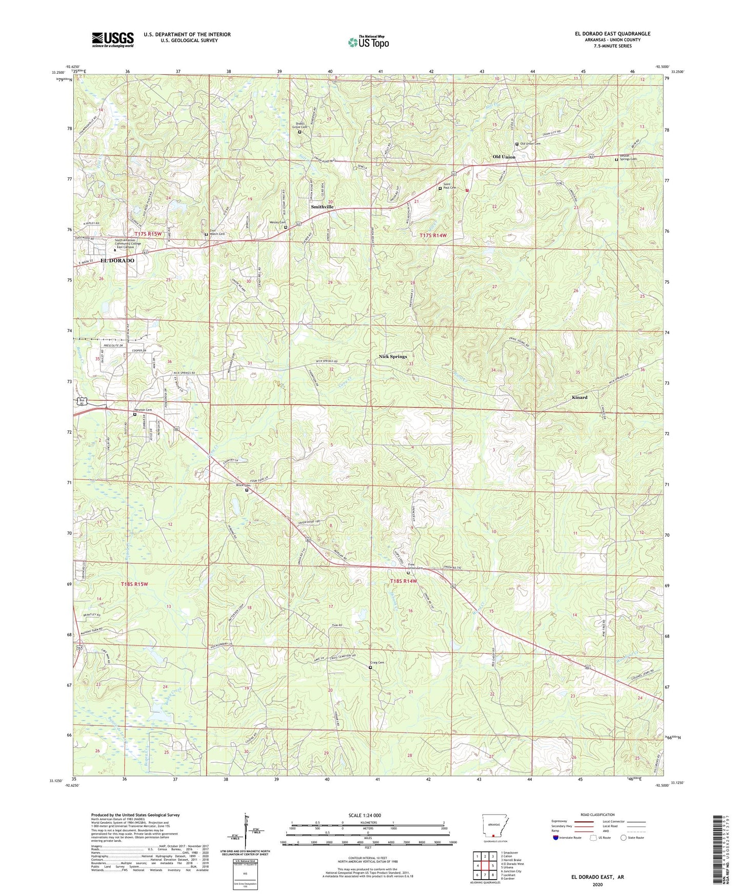
El Dorado East Arkansas US Topo Map
Couldn't load pickup availability
2024 topographic map quadrangle El Dorado East in the state of Arkansas. Scale: 1:24000. Based on the newly updated USGS 7.5' US Topo map series, this map is in the following counties: Union. The map contains contour data, water features, and other items you are used to seeing on USGS maps, but also has updated roads and other features. This is the next generation of topographic maps. Printed on high-quality waterproof paper with UV fade-resistant inks.
Quads adjacent to this one:
West: El Dorado West
Northwest: Smackover
North: Calion
Northeast: Harrell Brake
East: Urbana
Southeast: Gardner
South: Lockhart
Southwest: Junction City
This map covers the same area as the classic USGS quad with code o33092b5.
Contains the following named places: Beulah Springs Baptist Church, Beulah Springs Cemetery, Bogay Creek, Brock Cemetery, Cany Creek, Craig Cemetery, East El Dorado Oil Field, Ezell Oil Field, Free Union Cemetery, Free Union Church, Hillsboro Oil Field, Kinard, Kingdom Hall of Jehovahs Witnesses, Newton Cemetery, Nick Springs, Nick Springs Lookout Tower, Nick Springs Oil Field, Oil Belt Vocational Technical School, Old Union, Old Union Cemetery, Old Union Volunteer Fire Department, Perdue City, ProMed Ambulance El Dorado, Saint Paul Cemetery, Saint Pauls Church, Shady Grove Cemetery, Smithville, Souls Chapel Church of Christ, Temple Baptist Church, Union Baptist Chucch, Union County, Union Elementary School, Union High School, Union School, Ward Creek, Wesley Cemetery, Wesley Chapel Methodist Church, Woodley Oil Field, Zion Watch Baptist Church, Zion Watch Cemetery