MyTopo
Lockhart Louisiana US Topo Map
Couldn't load pickup availability
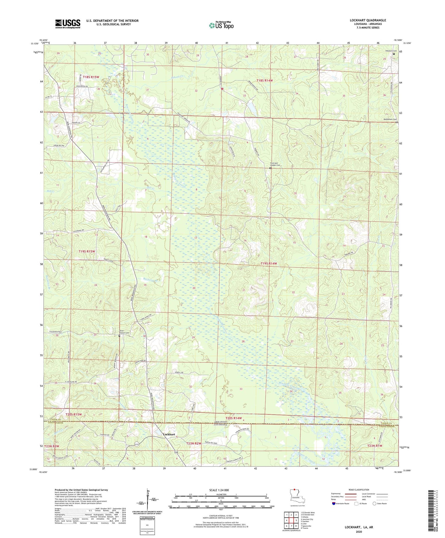
2024 topographic map quadrangle Lockhart in the states of Arkansas, Louisiana. Scale: 1:24000. Based on the newly updated USGS 7.5' US Topo map series, this map is in the following counties: Union. The map contains contour data, water features, and other items you are used to seeing on USGS maps, but also has updated roads and other features. This is the next generation of topographic maps. Printed on high-quality waterproof paper with UV fade-resistant inks.
Quads adjacent to this one:
West: Junction City
Northwest: El Dorado West
North: El Dorado East
Northeast: Urbana
East: Gardner
Southeast: Truxno
South: Spearsville
Southwest: Lillie
This map covers the same area as the classic USGS quad with code o33092a5.
Contains the following named places: Bear Creek, Bethlehem Cemetery, Buckaloo Branch, Calvary Church, Ford and Golden Cemetery, Golden School, Hibank Church, Hibank Creek, Hibank Oil Field, Hibanks Volunteer Fire Department, Hillsboro Cemetery, Lockhart, Mill Creek, Mount Moriah Church, Mount Zion Church, Olive Branch Cemetery, Olive Branch United Methodist Church, Pleasant Grove, Pleasant Grove Church