
MyTopo
Harrell Brake Arkansas US Topo Map
Couldn't load pickup availability
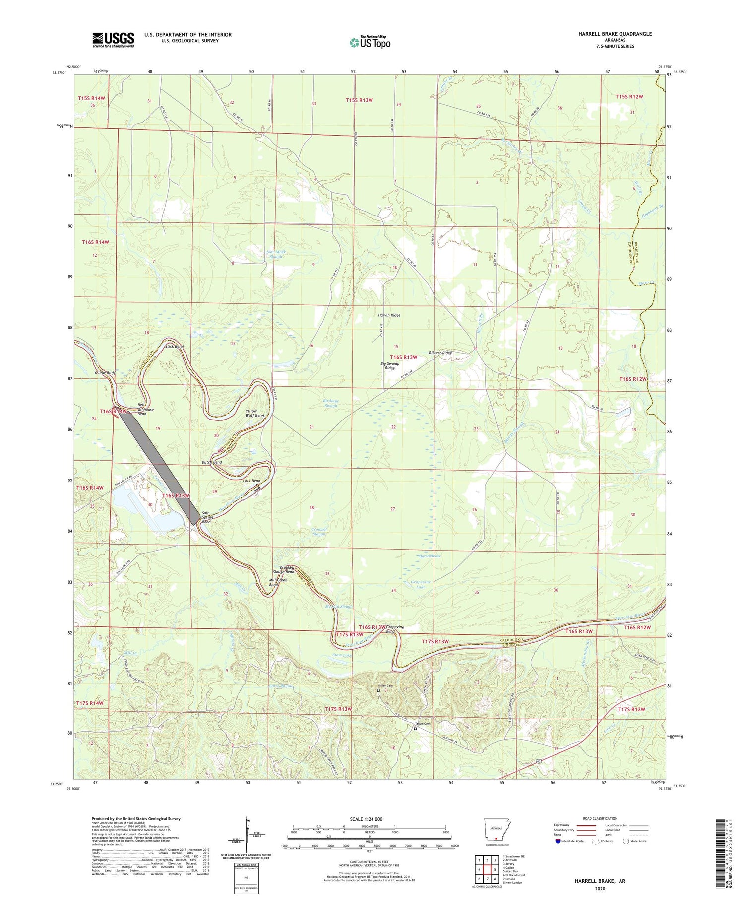
2024 topographic map quadrangle Harrell Brake in the state of Arkansas. Scale: 1:24000. Based on the newly updated USGS 7.5' US Topo map series, this map is in the following counties: Calhoun, Union, Bradley. The map contains contour data, water features, and other items you are used to seeing on USGS maps, but also has updated roads and other features. This is the next generation of topographic maps. Printed on high-quality waterproof paper with UV fade-resistant inks.
Quads adjacent to this one:
West: Calion
Northwest: Smackover NE
North: Artesian
Northeast: Jersey
East: Moro Bay
Southeast: New London
South: Urbana
Southwest: El Dorado East
This map covers the same area as the classic USGS quad with code o33092c4.
Contains the following named places: Bangs Landing, Bell Ginhouse Bend, Beulah Springs School, Big Swamp Ridge, Birdseye Slough, Brann School, Buckhorn Branch, Calion Lock and Dam, Crooked Slough, Crooked Slough Bend, Cypress Creek, Cypress Creek Oil Field, Dutch Bend, Ebenezer School, Gilbert Ridge, Grapevine Bend, Grapevine Lake, Harrell Brake, Harrell Branch, Harvin Ridge, Highbank Branch, Hurricane Creek, John Mack Slough, Jones Bayou, Lewter Creek, Lloyd Creek, Lloyd Ford, Lock and Dam Number 8, Lock and Dam Number Eight, Lock Bend, McCain Slough, McClendon Branch, Mill Creek, Mill Creek Bend, Miller Cemetery, Ouachita River Reservoir, Salt Spring Bend, Stick Bend, Stow Lake, Stow Landing, Tatum Cemetery, Township of Fayette, Tuckers Camp, Wilmington Landing, Wilmington Oil and Gas Field, Wolf Branch, Yellow Bluff, Yellow Bluff Bend


