
MyTopo
Urbana Arkansas US Topo Map
Couldn't load pickup availability
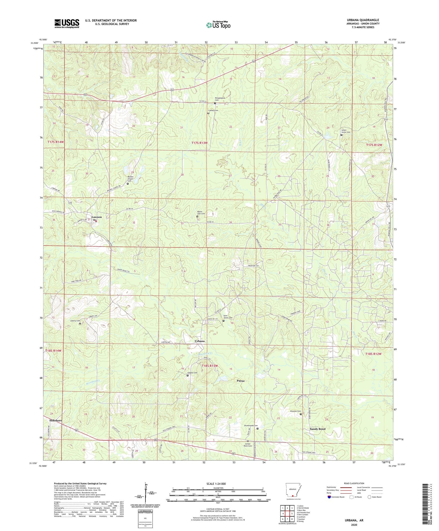
2024 topographic map quadrangle Urbana in the state of Arkansas. Scale: 1:24000. Based on the newly updated USGS 7.5' US Topo map series, this map is in the following counties: Union. The map contains contour data, water features, and other items you are used to seeing on USGS maps, but also has updated roads and other features. This is the next generation of topographic maps. Printed on high-quality waterproof paper with UV fade-resistant inks.
Quads adjacent to this one:
West: El Dorado East
Northwest: Calion
North: Harrell Brake
Northeast: Moro Bay
East: New London
Southeast: Strong
South: Gardner
Southwest: Lockhart
This map covers the same area as the classic USGS quad with code o33092b4.
Contains the following named places: Cathey Cemetery, Center Point Cemetery, Church of God in Christ, Crossroads School, Drummonds Cemetery, Dry Creek, Green Grove Cemetery, Green Grove Chapel, Green Grove Church, Hillsboro, Knowles Baptist Church, Knowles Cemetery, Lawson, Lawson - Urbana Volunteer Fire Department, Lawson Baptist Church, Lawson Census Designated Place, Lawson Oil and Gas Field, Lawson Post Office, Liberty Baptist Church, Liberty Cemetery, Mount Zion Cemetery, Mount Zion Church, Payne, Philadelphia Baptist Church, Philadelphia Cemetery, Rhodes Chapel Cemetery, Rhodes Chapel United Methodist Church, Saint James Cemetery, Sandy Bend, Sandy Bend Oil Field, Sandybend, Township of Wilmington, Urbana, Urbana Baptist Church, Urbana Cemetery, Urbana Census Designated Place, Urbana Oil Field, Urbana Post Office, Woodard Creek


