MyTopo
Evening Shade Arkansas US Topo Map
Couldn't load pickup availability
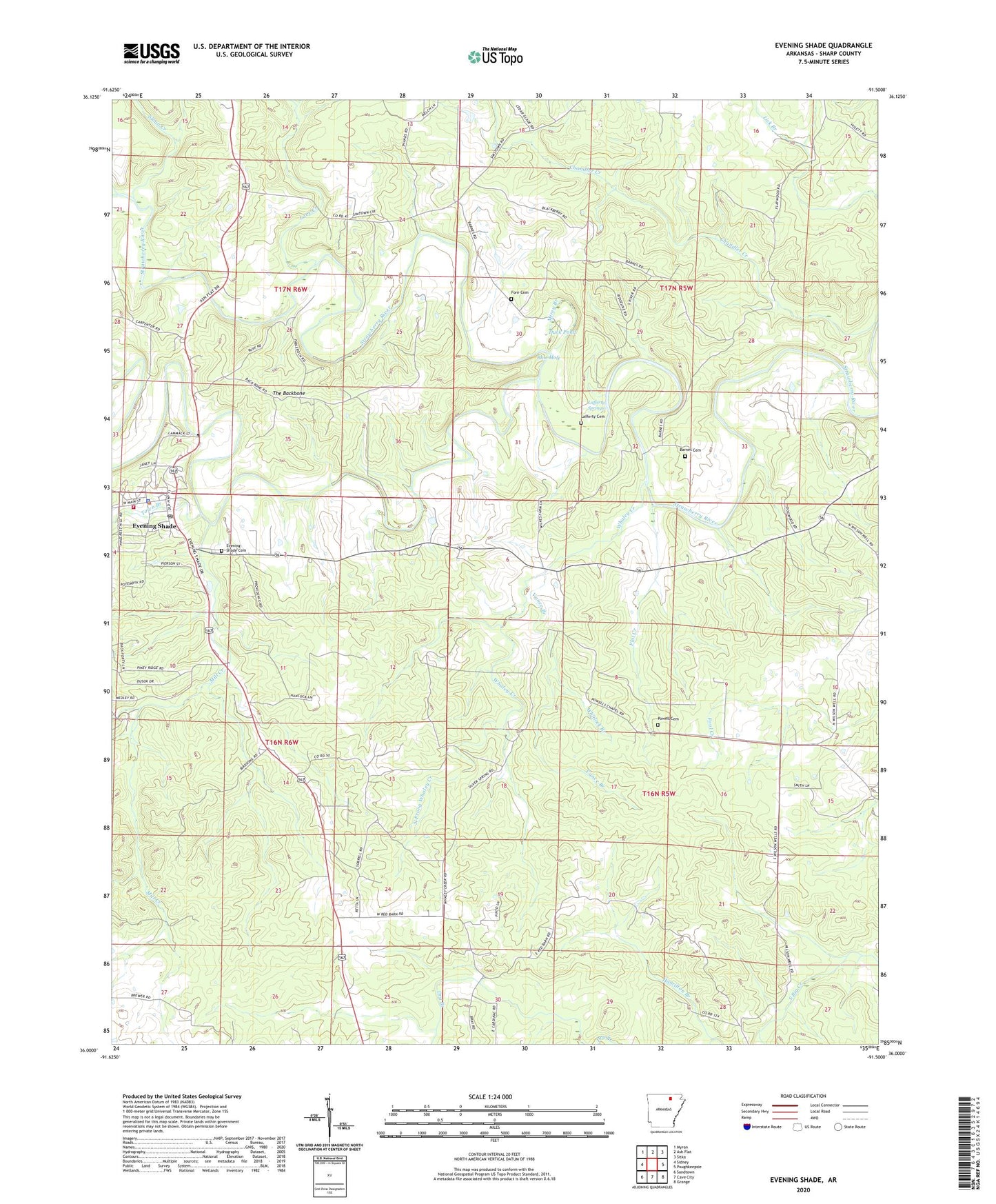
2024 topographic map quadrangle Evening Shade in the state of Arkansas. Scale: 1:24000. Based on the newly updated USGS 7.5' US Topo map series, this map is in the following counties: Sharp. The map contains contour data, water features, and other items you are used to seeing on USGS maps, but also has updated roads and other features. This is the next generation of topographic maps. Printed on high-quality waterproof paper with UV fade-resistant inks.
Quads adjacent to this one:
West: Sidney
Northwest: Myron
North: Ash Flat
Northeast: Sitka
East: Poughkeepsie
Southeast: Grange
South: Cave City
Southwest: Sandtown
This map covers the same area as the classic USGS quad with code o36091a5.
Contains the following named places: Amateur, Balboa, Barnes Cemetery, Blue Hole, City of Evening Shade, Dry Branch, Duck Pond, Evening Shade, Evening Shade Cemetery, Evening Shade Elementary School, Evening Shade High School, Evening Shade Police Department, Evening Shade Post Office, Evening Shade Volunteer Fire Station, Flat Creek, Flatwoods Church, Fore Cemetery, Hamilton Branch, Lafferty Cemetery, Lafferty Springs, Lave Creek, Mill Creek, Mirey Branch, North Prong Whaley Creek, Piney Fork, Powell Cemetery, Powell Chapel, Sloan Creek, The Backbone, Town Branch, Township of Sullivan, Township of Washington, Vance Branch, Whaley Creek, Whitlock Branch, ZIP Code: 72532