MyTopo
Sandtown Arkansas US Topo Map
Couldn't load pickup availability
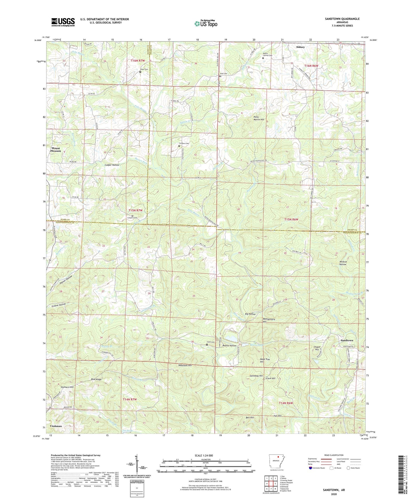
2024 topographic map quadrangle Sandtown in the state of Arkansas. Scale: 1:24000. Based on the newly updated USGS 7.5' US Topo map series, this map is in the following counties: Independence, Sharp, Izard. The map contains contour data, water features, and other items you are used to seeing on USGS maps, but also has updated roads and other features. This is the next generation of topographic maps. Printed on high-quality waterproof paper with UV fade-resistant inks.
Quads adjacent to this one:
West: Mount Pleasant
Northwest: Zion
North: Sidney
Northeast: Evening Shade
East: Cave City
Southeast: Sulphur Rock
South: Batesville
Southwest: Bethesda
This map covers the same area as the classic USGS quad with code o35091h6.
Contains the following named places: Adler-Southard Mine, Alvis, Aydelotte Washer, Barnett Mine, Barren Fork, Barren Fork Church, Beatty Hollow, Beatty Pond, Bell Hill, Bell Hill Prospect, Big Hollow, Blue Ridge, Blue Ridge Mine, Bone Prospect, Brushy Branch, C C Johnson Prospect, C W Maxfield Prospect, Chapel Hill, Chapel Hill Mine, Clark Cemetery, Clark Hill, Conyers Cemetery, Conyers Spring School, Coon Creek, Cooper Hollow, Cripple Hill Prospect, Dead Tree Hill, Dead Tree Hill Prospect, Dishwater Branch, Dry Creek, Eutopia Church, Fall Hill, Friday Prospect, G W W Patterson Prospect, Galloway Hill, Galloway Mine, Grub Cut Mine, Hackley Branch, Helms Prospect, Henry King Prospect, Kimmer Mine, Kirk Cemetery, Klondike Mine, KZLE-FM (Batesville), Lassiter Mine, Lees Chapel, Liberty School, Lower Bone School, Martins Store, Maxfield Prospect, Miller Prong, Montgomery Branch, Montgomery Chapel, Montgomery Hill, Montgomery Hill Mine, Montgomery Mine, Montgomery Prospect, Mount Carmel Cemetery, Napoleon Hill, Peter Martin Hill, Pine Branch, Pine Hill School, Pleasant Valley School, Polk Southard Mines, Pool Chapel, Pool Prospect, Pritchett Prospect, Providence Church, Reed Mine, Roach Mine, Rocky Branch, Rogers Mine, Roseborough Mine, Rowe Field Mine, Saint Pauls Church, Sandtown, Section 34 Prospect, Shaw Cemetery, Sidney Creek, Simpson Prospect, Sis Clark Corner Prospect, Sis Clark Mine, Southern Hill, Southern Mine, Tate Spring, Thompson School, Township of Barren Fork, Township of Jefferson, Township of Johnson, Township of West Sullivan, Turner Mine, United States Mag Corp Lake, United States Mag Corp Lake Dam, Watkins Branch, Wildcat Hollow, Wolf School, Wren Mine