MyTopo
Poughkeepsie Arkansas US Topo Map
Couldn't load pickup availability
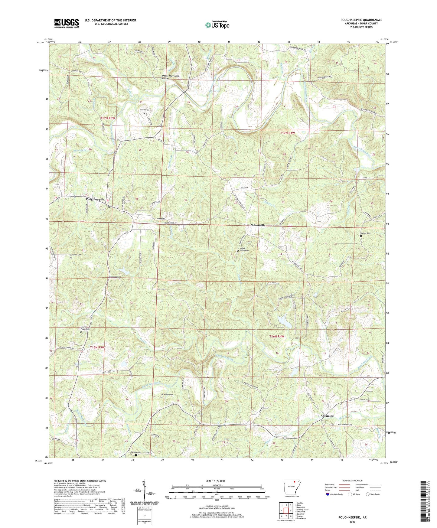
2024 topographic map quadrangle Poughkeepsie in the state of Arkansas. Scale: 1:24000. Based on the newly updated USGS 7.5' US Topo map series, this map is in the following counties: Sharp. The map contains contour data, water features, and other items you are used to seeing on USGS maps, but also has updated roads and other features. This is the next generation of topographic maps. Printed on high-quality waterproof paper with UV fade-resistant inks.
Quads adjacent to this one:
West: Evening Shade
Northwest: Ash Flat
North: Sitka
Northeast: Ravenden
East: Smithville
Southeast: Strawberry
South: Grange
Southwest: Cave City
This map covers the same area as the classic USGS quad with code o36091a4.
Contains the following named places: Bandy Branch, Ben-Gay, Blakes Branch, Bridgeport, Brooks Hurricane Hollow, Calamine, Calamine Post Office, Cedar Creek, Chandler Creek, Fool Creek, Freeman Branch, Grange - Calamine Volunteer Fire Department Substation, Hurricane Creek, James Spring Cemetery, Jarrett Cemetery, Lebanon Church, Lick Branch, Marvin Cemetery, McAdams Cemetery, Meeks Branch, Mill Creek, Mount Pisgah Cemetery, Nelsonville, North Big Creek, Parsley Cemetery, Poughkeepsie, Poughkeepsie Elementary School, Poughkeepsie High School, Poughkeepsie Post Office, Poughkeepsie Volunteer Fire Department, Reed, Rings Chapel, Runnels Branch, Spotts Cemetery, Spring Creek, Street Lake, Street Lake Dam, Township of Big Creek, Township of Big Rock, Township of North Big Rock, Township of South Big Rock, Township of Strawberry