MyTopo
Jersey Arkansas US Topo Map
Couldn't load pickup availability
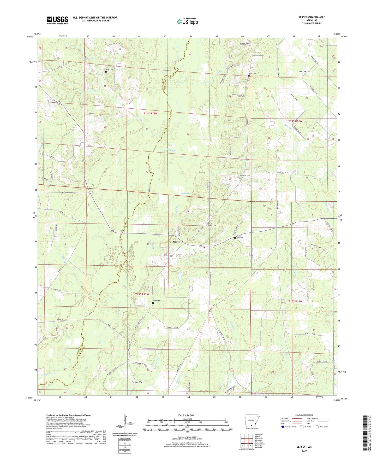
2024 topographic map quadrangle Jersey in the state of Arkansas. Scale: 1:24000. Based on the newly updated USGS 7.5' US Topo map series, this map is in the following counties: Bradley, Calhoun. The map contains contour data, water features, and other items you are used to seeing on USGS maps, but also has updated roads and other features. This is the next generation of topographic maps. Printed on high-quality waterproof paper with UV fade-resistant inks.
Quads adjacent to this one:
West: Artesian
Northwest: Hampton
North: Banks
Northeast: Farmville
East: Hermitage
Southeast: Marsden
South: Moro Bay
Southwest: Harrell Brake
This map covers the same area as the classic USGS quad with code o33092d3.
Contains the following named places: At Church, Bailey Ford, Beech Branch, Belin Cemetery, Child School, Dunn Creek, Hines Cemetery, Jersey, Jersey Methodist Church, Jersey Post Office, Jersey Rural Fire Department, Jersey School, Jolly Creek, Jordan Branch, Lavilliam Cemetery, Lee Branch, Mill Branch, Mill Ford, Mount Zion Baptist Church, Mount Zion Cemetery, Mud Springs, Pin Oak Flat, Primitive Baptist Church, Ricks Cemetery, Ricks Church, Robinson Branch, Saint Lena School, Shady Grove Cemetery, Shady Grove Missionary Baptist Church, Township of Jackson, Township of Sumpter, Union Grove Church, Villum Branch, Wahl Branch