MyTopo
Lake Norrell Arkansas US Topo Map
Couldn't load pickup availability
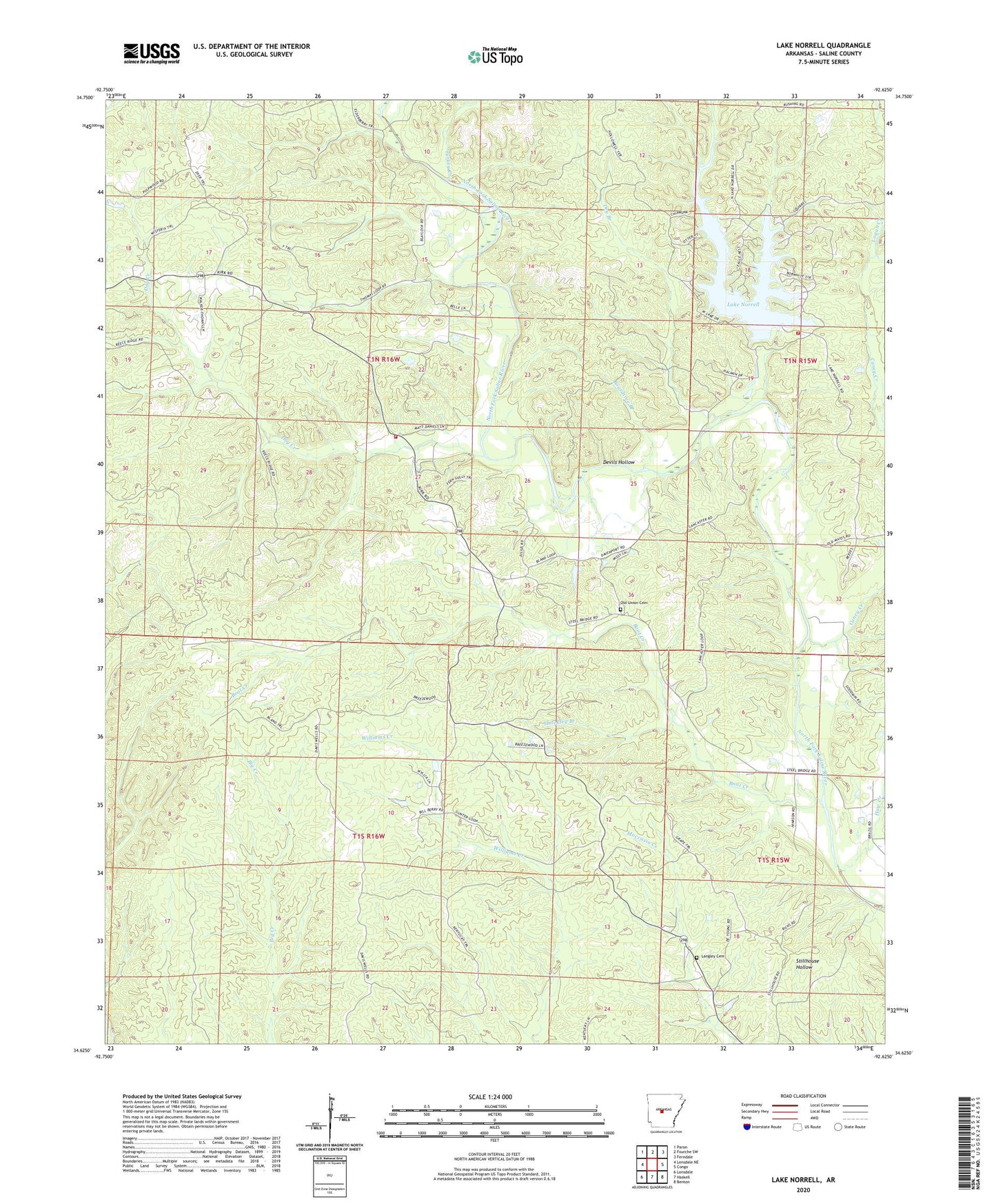
2024 topographic map quadrangle Lake Norrell in the state of Arkansas. Scale: 1:24000. Based on the newly updated USGS 7.5' US Topo map series, this map is in the following counties: Saline. The map contains contour data, water features, and other items you are used to seeing on USGS maps, but also has updated roads and other features. This is the next generation of topographic maps. Printed on high-quality waterproof paper with UV fade-resistant inks.
Quads adjacent to this one:
West: Lonsdale NE
Northwest: Paron
North: Fourche SW
Northeast: Ferndale
East: Congo
Southeast: Benton
South: Haskell
Southwest: Lonsdale
This map covers the same area as the classic USGS quad with code o34092f6.
Contains the following named places: Bivens Grove Church, Bland, Boardtree Branch, Boot Creek, Brushy Creek, Caney Creek, Devils Hollow, Dog Creek, Dry Branch, Faith Church, Grape, Grape Chapel, Haw Creek, Hickory Flats, Lake Norrell, Lake Norrell Dam, Lake Norrell Volunteer Fire Department Station 1, Langley Cemetery, Logan Creek, Old Union Cemetery, Old Union Church, Salem Fire Department Station 3, Saline County, Shockley Branch, Township of Union, Turkey Creek, Wildwood Church, ZIP Code: 72019