MyTopo
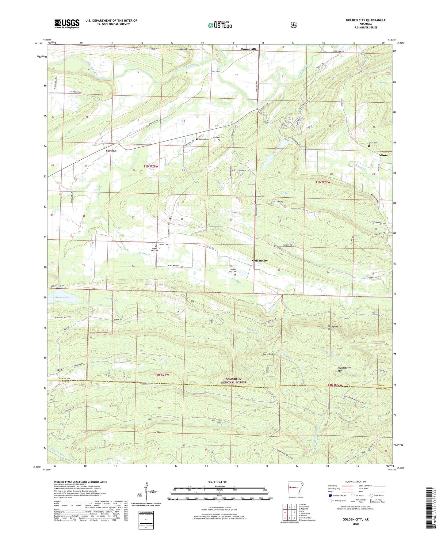
Golden City Arkansas US Topo Map
Couldn't load pickup availability
Also explore the Golden City Forest Service Topo of this same quad for updated USFS data
2024 topographic map quadrangle Golden City in the state of Arkansas. Scale: 1:24000. Based on the newly updated USGS 7.5' US Topo map series, this map is in the following counties: Logan, Scott. The map contains contour data, water features, and other items you are used to seeing on USGS maps, but also has updated roads and other features. This is the next generation of topographic maps. Printed on high-quality waterproof paper with UV fade-resistant inks.
Quads adjacent to this one:
West: Ione
Northwest: Barber
North: Booneville
Northeast: Magazine
East: Sugar Grove
Southeast: Freedom Mountain
South: Bee Mountain
Southwest: Waldron
This map covers the same area as the classic USGS quad with code o35093a8.
Contains the following named places: Arkansas Childrens Colony, Auxiliary Dam Number One, Auxiliary Dam Number Two, Bear Mountain, Boy Scouts Lake Dam, Brushy Creek, Buck Knob, Buck Knob Creek, Carolan, Carolyn Church, Earl Prairie, Fletcher Creek, Girard, Golden City, Golden City Cemetery, Golden City Volunteer Fire Department, Greasy Creek, Hamby Cemetery, Hopewell Cemetery, Huckleberry Mountain, Human Development Center, Keenan Lake, KEZU-FM (Booneville), Logan Hall Cemetery, Logan Hall Church, Mixon, Mixon Baptist Church, Mixon Cemetery, Montgomery Mountain, Oliver Cemetery, Perkins Branch, Tate, Township of Cauthron, Union Hope Baptist Church, ZIP Code: 72927