MyTopo
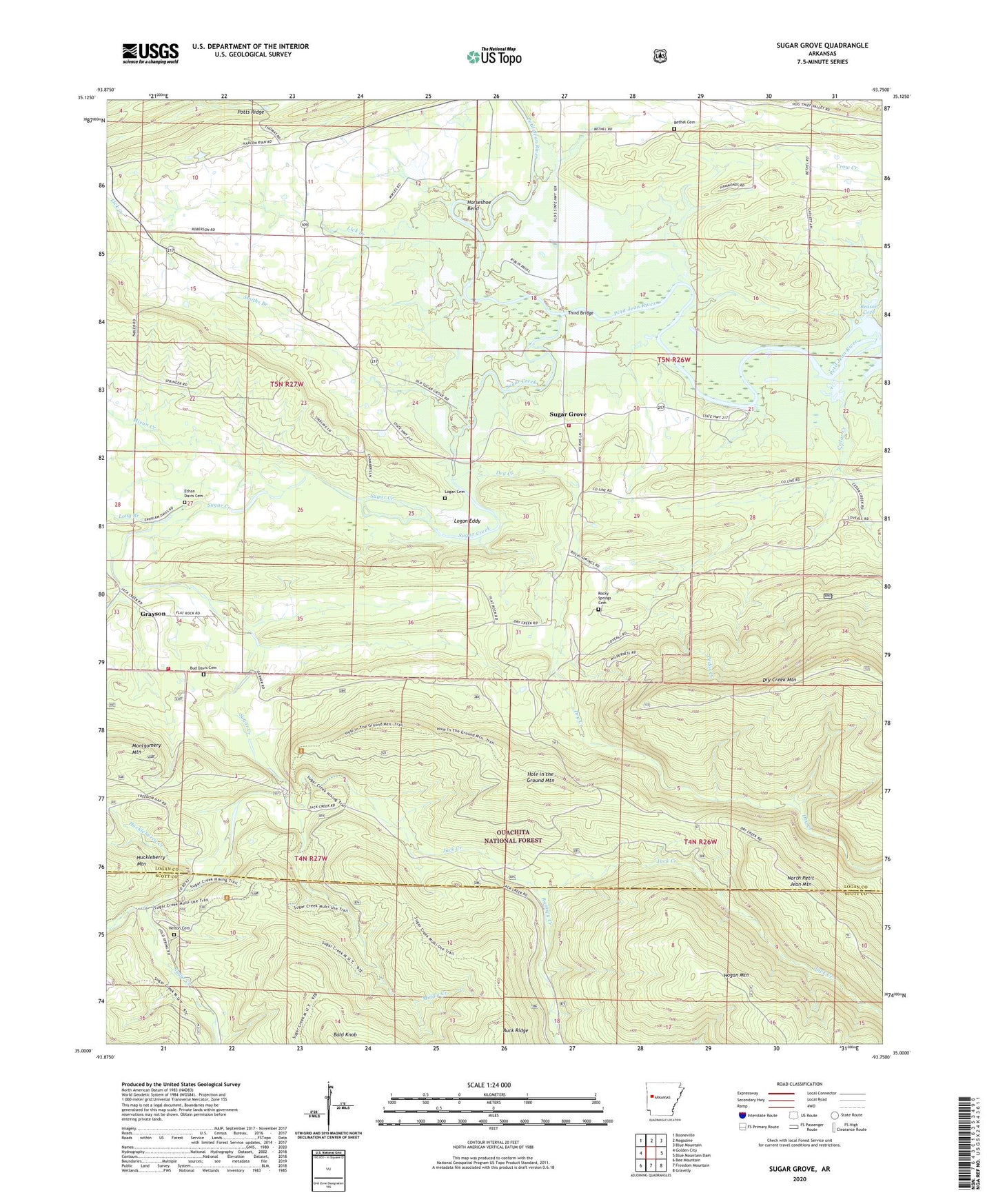
Sugar Grove Arkansas US Topo Map
Couldn't load pickup availability
Also explore the Sugar Grove Forest Service Topo of this same quad for updated USFS data
2024 topographic map quadrangle Sugar Grove in the state of Arkansas. Scale: 1:24000. Based on the newly updated USGS 7.5' US Topo map series, this map is in the following counties: Logan, Scott. The map contains contour data, water features, and other items you are used to seeing on USGS maps, but also has updated roads and other features. This is the next generation of topographic maps. Printed on high-quality waterproof paper with UV fade-resistant inks.
Quads adjacent to this one:
West: Golden City
Northwest: Booneville
North: Magazine
Northeast: Blue Mountain
East: Blue Mountain Dam
Southeast: Gravelly
South: Freedom Mountain
Southwest: Bee Mountain
This map covers the same area as the classic USGS quad with code o35093a7.
Contains the following named places: Bald Knob, Beason Cove, Bethel Cemetery, Brown School, Buck Ridge, Bud Davis Cemetery, Cedar Creek, Cold Springs Work Center, Dry Creek, Ethan Davis Cemetery, Grayson, Grayson Volunteer Fire Department Station 1, Helton Cemetery, Hise Hill Recreation Area, Hole in the Ground Mountain, Horseshoe Bend, Huckleberry Creek, Jack Creek, Jack Creek Recreation Area, Jack Creek Recreation Site, Knoppers Ford Recreation Area, Lick Creek, Lick Creek Church, Lick Creek School, Logan Cemetery, Logan Eddy, Long Branch, Middle Creek, Mixon Creek, Mountain Grove, Potts Ridge, Ramsey Creek, Right Hand Sugar Creek, Rocky Springs Cemetery, Scott Lake, Shady Grove School, Smiths Branch, Sugar Creek, Sugar Grove, Sugar Grove Fire Department, Third Bridge, Township of Petit Jean, Township of Sugar Creek