MyTopo
Goosepond Mountain Arkansas US Topo Map
Couldn't load pickup availability
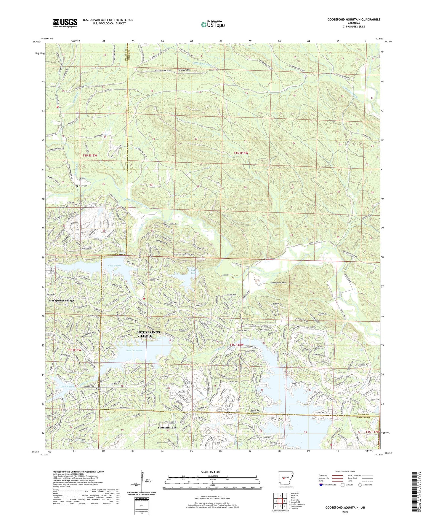
2024 topographic map quadrangle Goosepond Mountain in the state of Arkansas. Scale: 1:24000. Based on the newly updated USGS 7.5' US Topo map series, this map is in the following counties: Saline, Garland. The map contains contour data, water features, and other items you are used to seeing on USGS maps, but also has updated roads and other features. This is the next generation of topographic maps. Printed on high-quality waterproof paper with UV fade-resistant inks.
Quads adjacent to this one:
West: Jessieville
Northwest: Nimrod SE
North: Paron SW
Northeast: Paron
East: Lonsdale NE
Southeast: Lonsdale
South: Fountain Lake
Southwest: Hot Springs North
This map covers the same area as the classic USGS quad with code o34092f8.
Contains the following named places: Angling Creek, Antioch Church, Balboa Golf Course, Beaudry, Blocher, Brushy Creek, Coronado Golf Course, Cortez Golf Course, Electric, Goosepond Mountain, Hot Springs Village, Hot Springs Village Census Designated Place, Hot Springs Village Fire Department Cortez Station, Hot Springs Village Fire Department Station 3, Howard Mountain, Jessieville Fire Department Station 3, Lake Balboa, Lake Coronado, Lake Coronado Dam, Lake Cortez, Lake Cortez Dam, Lake Lago, Lake Lago Dam, Lake Pineda, Little Alum Fork, Marble Landmark Church, Mill Creek, Pineda Dam, Talley Cemetery, Township of Marble, ZIP Code: 71909