MyTopo
Fountain Lake Arkansas US Topo Map
Couldn't load pickup availability
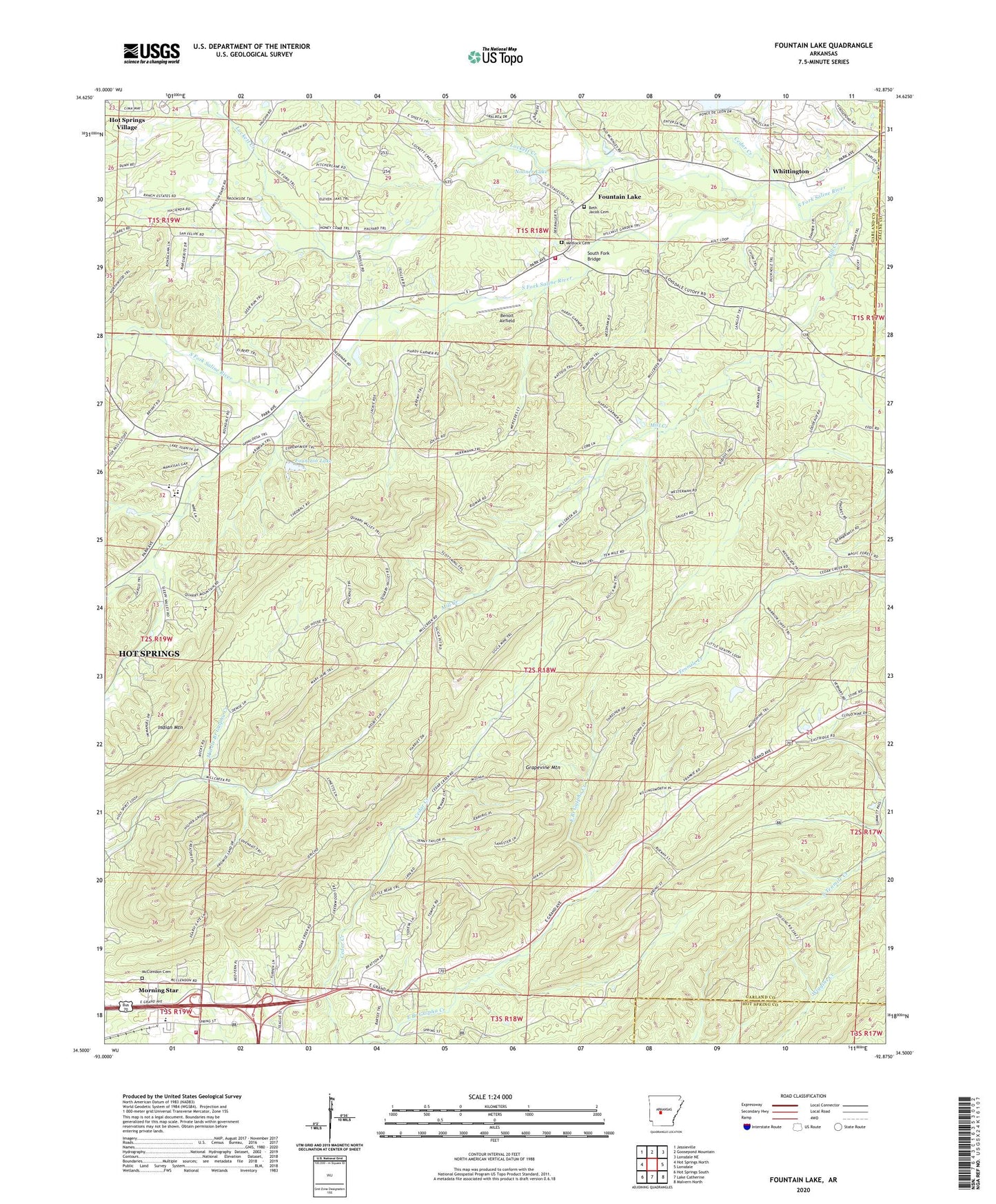
2024 topographic map quadrangle Fountain Lake in the state of Arkansas. Scale: 1:24000. Based on the newly updated USGS 7.5' US Topo map series, this map is in the following counties: Garland, Hot Spring, Saline. The map contains contour data, water features, and other items you are used to seeing on USGS maps, but also has updated roads and other features. This is the next generation of topographic maps. Printed on high-quality waterproof paper with UV fade-resistant inks.
Quads adjacent to this one:
West: Hot Springs North
Northwest: Jessieville
North: Goosepond Mountain
Northeast: Lonsdale NE
East: Lonsdale
Southeast: Malvern North
South: Lake Catherine
Southwest: Hot Springs South
This map covers the same area as the classic USGS quad with code o34092e8.
Contains the following named places: Benoit Airfield, Beth Jacob Cemetery, Cedar Creek, Center Hill Church, Cutter - Morning Star Elementary School, Cutter - Morning Star High School, Dripping Springs, Fountain Lake, Fountain Lake Charter High School, Fountain Lake Dam, Fountain Lake Elementary School, Fountain Lake Fire Department Station 1, Grapevine Mountain, Gulpha, High Point, Lockett Creek, McClendon Cemetery, Medlock Cemetery, Mill Creek, Mill Creek Baptist Church, Morning Star, Morning Star Church, Morning Star Fire Department Station 1, Nooner Lake, Nooner Lake Dam, Oak Hill Church, O'Mahoney Pond, O'Mahoney Pond Dam, Peaceful Valley Church, Rockdale Church, South Fork Bridge, Town of Fountain Lake, Township of Whittington, Whittington, ZIP Code: 71901