MyTopo
Lonsdale Arkansas US Topo Map
Couldn't load pickup availability
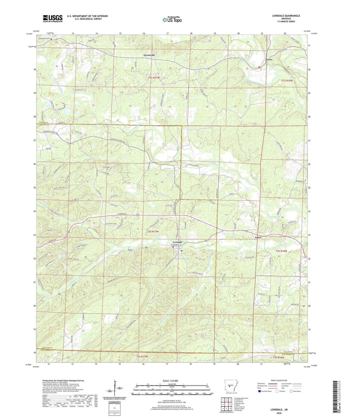
2024 topographic map quadrangle Lonsdale in the state of Arkansas. Scale: 1:24000. Based on the newly updated USGS 7.5' US Topo map series, this map is in the following counties: Garland, Saline, Hot Spring. The map contains contour data, water features, and other items you are used to seeing on USGS maps, but also has updated roads and other features. This is the next generation of topographic maps. Printed on high-quality waterproof paper with UV fade-resistant inks.
Quads adjacent to this one:
West: Fountain Lake
Northwest: Goosepond Mountain
North: Lonsdale NE
Northeast: Lake Norrell
East: Haskell
Southeast: Traskwood
South: Malvern North
Southwest: Lake Catherine
This map covers the same area as the classic USGS quad with code o34092e7.
Contains the following named places: Cedar Grove Church, Crows, Crows Volunteer Fire Department, Lake Isabella, Lonsdale, Lonsdale Fire Department Station 1, Lonsdale Fire Department Station 2, Lonsdale Post Office, Meaford, Nance, Owensville, Pleasant Run Creek, Rural Dale School, Slate Branch Cemetery, Smith Creek Church, South Tenmile Creek, Spring Lake, Spring Lake Dam, Ten Mile Missionary Baptist Church, Town of Lonsdale, Township of Liberty, Township of Phillips, ZIP Code: 72087