MyTopo
Greenway Arkansas US Topo Map
Couldn't load pickup availability
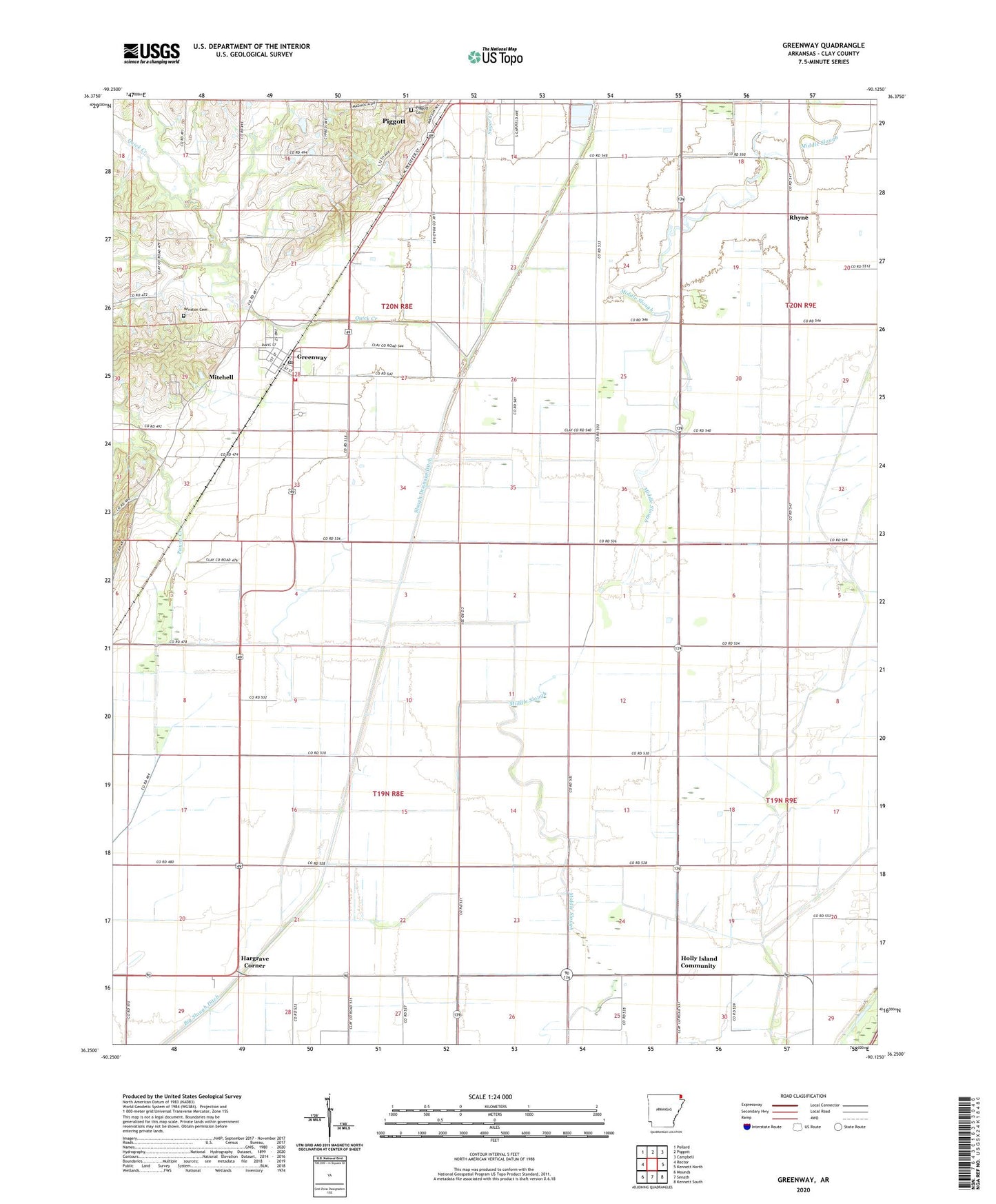
2024 topographic map quadrangle Greenway in the state of Arkansas. Scale: 1:24000. Based on the newly updated USGS 7.5' US Topo map series, this map is in the following counties: Clay. The map contains contour data, water features, and other items you are used to seeing on USGS maps, but also has updated roads and other features. This is the next generation of topographic maps. Printed on high-quality waterproof paper with UV fade-resistant inks.
Quads adjacent to this one:
West: Rector
Northwest: Pollard
North: Piggott
Northeast: Campbell
East: Kennett North
Southeast: Kennett South
South: Senath
Southwest: Mounds
This map covers the same area as the classic USGS quad with code o36090c2.
Contains the following named places: Calls Church, Calls School, City of Greenway, Greenway, Greenway Fire Station, Greenway Post Office, Hammett, Hampton Slough, Hargrave Corner, Hays School, Holly Island Church, Holly Island Community, Middle Slough, Mitchell, Payne Creek, Phifer School, Piggott Cemetery, Piggott Industrial Park, Pleasant Valley Church, Pleasant Valley School, Quick Creek, Rhyne, Slough Drainage Ditch, Township of East Oak Bluff-Blue Cane, Township of Haywood, Township of South Saint Francis, Union Grove Church, Union Grove School, Union Home Church, Vincent School, Walnut Grove Church, Walnut Grove School, Winston Cemetery, ZIP Code: 72430