MyTopo
Rector Arkansas US Topo Map
Couldn't load pickup availability
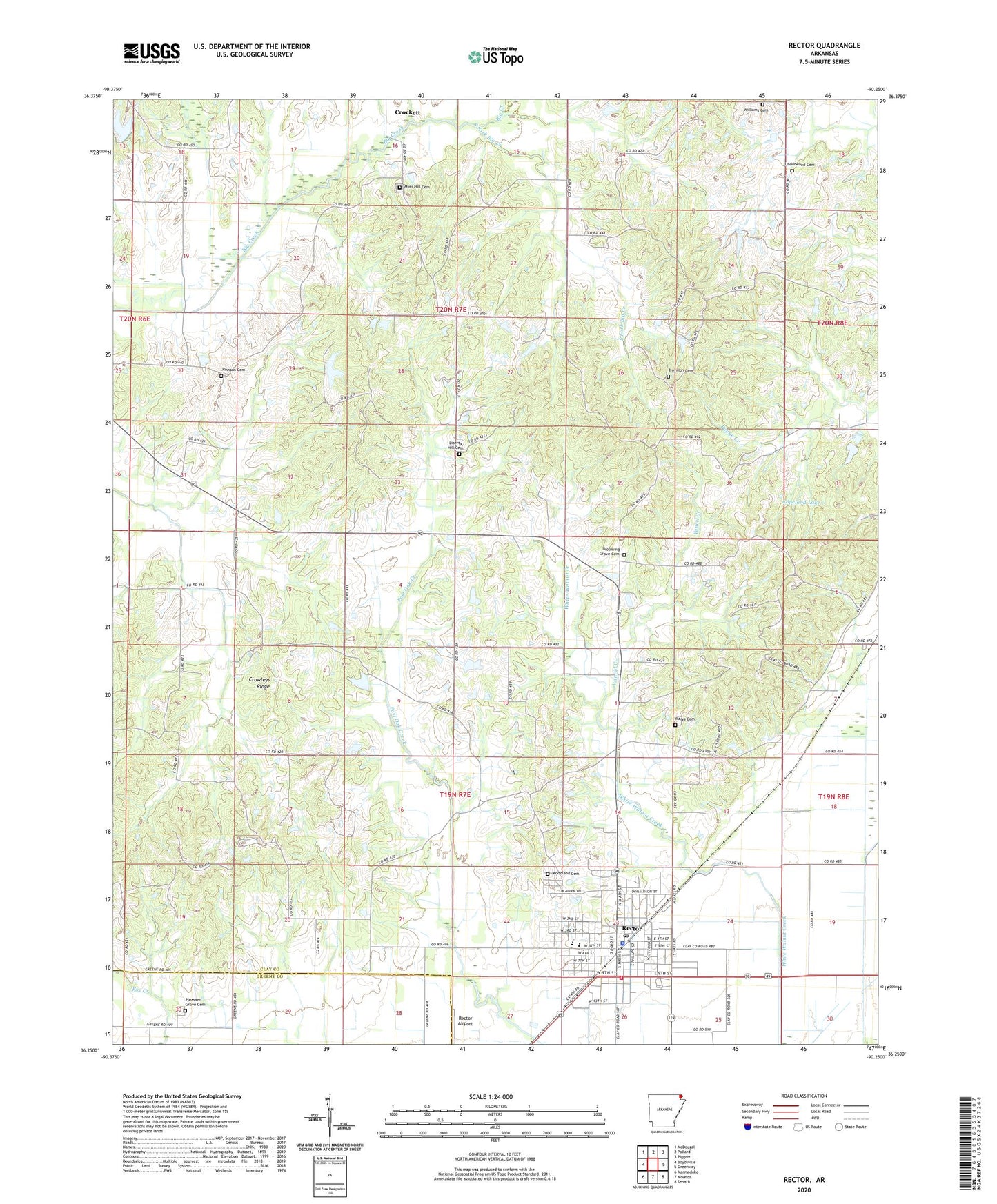
2024 topographic map quadrangle Rector in the state of Arkansas. Scale: 1:24000. Based on the newly updated USGS 7.5' US Topo map series, this map is in the following counties: Clay, Greene. The map contains contour data, water features, and other items you are used to seeing on USGS maps, but also has updated roads and other features. This is the next generation of topographic maps. Printed on high-quality waterproof paper with UV fade-resistant inks.
Quads adjacent to this one:
West: Boydsville
Northwest: McDougal
North: Pollard
Northeast: Piggott
East: Greenway
Southeast: Senath
South: Mounds
Southwest: Marmaduke
This map covers the same area as the classic USGS quad with code o36090c3.
Contains the following named places: Big Creek, Blooming Grove Cemetery, Blooming Grove Church, Blooming Grove School, City of Rector, Clay County Central High School, Copeland Lake, Copeland Lake Dam, Easterwood Lake, Easterwood Lake Dam, Ebenezer Church, Fair View School, Forty-Four School, Glass School, Gravel Hill Church, Harmony Church, Hopewell Missionary Baptist Church, Johnson Cemetery, Johnson Chapel, Liberty Hill Cemetery, Liberty Hill Church, Mars Hill Church, Mary School, Marys Cemetery, Marys Chapel, Myer Hill Cemetery, Pleasant Grove Cemetery, Pleasant Grove Church, Post Oak Creek, Pratt, Rector, Rector Ambulance Service, Rector Elementary School, Rector High School, Rector Police Department, Rector Post Office, Rector Volunteer Fire Department, South Fork Big Creek, Township of Bradshaw-Haywood, Township of Oak Bluff, Township of West Oak Bluff, Trovillon Cemetery, Underwood Cemetery, Vancel Creek, Williams Cemetery, Woodland Cemetery, ZIP Code: 72461