MyTopo
Mounds Arkansas US Topo Map
Couldn't load pickup availability
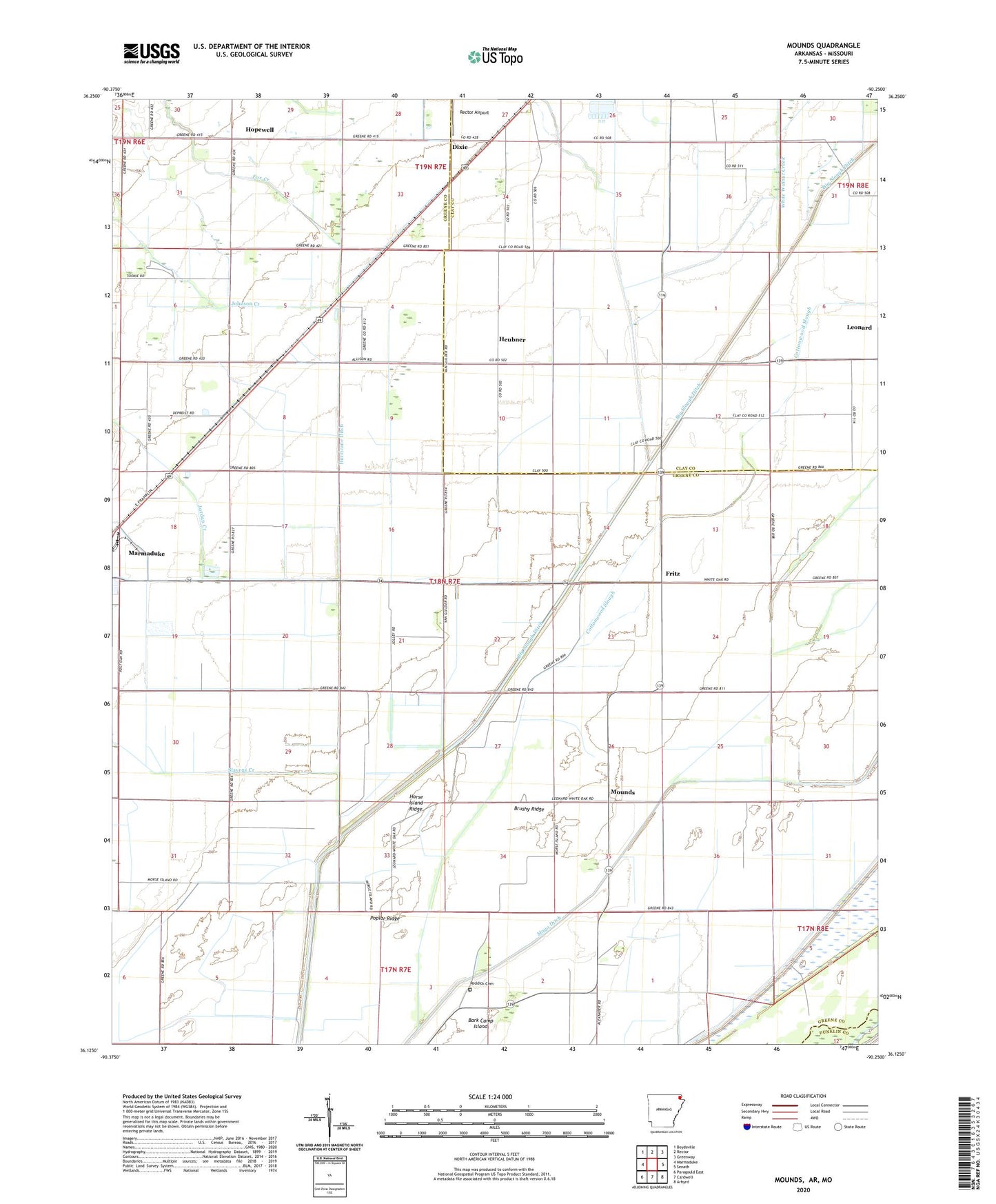
2024 topographic map quadrangle Mounds in the state of Arkansas. Scale: 1:24000. Based on the newly updated USGS 7.5' US Topo map series, this map is in the following counties: Greene, Clay, Dunklin. The map contains contour data, water features, and other items you are used to seeing on USGS maps, but also has updated roads and other features. This is the next generation of topographic maps. Printed on high-quality waterproof paper with UV fade-resistant inks.
Quads adjacent to this one:
West: Marmaduke
Northwest: Boydsville
North: Rector
Northeast: Greenway
East: Senath
Southeast: Arbyrd
South: Cardwell
Southwest: Paragould East
Contains the following named places: Bethel Church, Big Slough Ditch, Brushy Ridge, Cappadocia Church, Cottonwood Slough, Dixie, Five Oaks Methodist Church, Fox Creek, Fritz, Fritz School, Hebner Church, Hebner School, Heubner, Hopewell, Horse Island Ridge, Hurricane Ditch, Jay, Johnson Creek, Jordan Creek, Lambs Church, Leonard School, Lone Holly School, Mayo Ditch, Mound School, Mounds, Mount Hebron Church, Poplar Ridge, Post Oak School, Purcell School, Rector Airport, Reddick Cemetery, Reddick School, Slavens Creek, Talley School, Tokio Missionary Baptist Church, Tokio School, Township of Bagwell Lake, Township of Blue Cane, Township of Reynolds, Walnut Ridge School, White Walnut Creek