MyTopo
Okolona North Arkansas US Topo Map
Couldn't load pickup availability
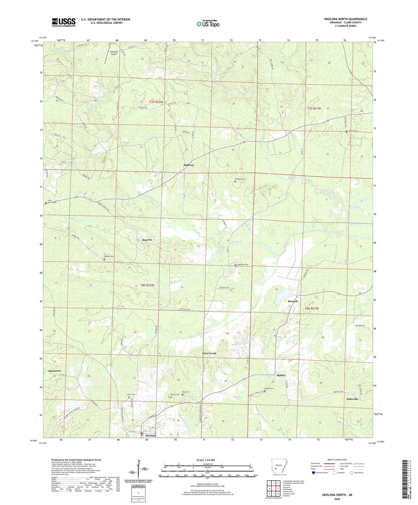
2024 topographic map quadrangle Okolona North in the state of Arkansas. Scale: 1:24000. Based on the newly updated USGS 7.5' US Topo map series, this map is in the following counties: Clark. The map contains contour data, water features, and other items you are used to seeing on USGS maps, but also has updated roads and other features. This is the next generation of topographic maps. Printed on high-quality waterproof paper with UV fade-resistant inks.
Quads adjacent to this one:
West: Antoine
Northwest: Chalybeate Mountain West
North: Chalybeate Mountain East
Northeast: De Gray
East: Hollywood
Southeast: Gurdon
South: Okolona South
Southwest: Piney Grove
This map covers the same area as the classic USGS quad with code o34093a3.
Contains the following named places: Bell Creek, Bethel, Bethel Cemetery, Bethel Church, Boswell, Boswell Lake, Boswell Lake Dam, Clear Spring Cemetery, Davidson Camp, Dobyville, Ebenezer Cemetery, Gentry Creek, Halfway, Haretown, Holly Grove Church, Holly Grove School, Kathleen Siding, Love Creek, McAlly Cemetery, Okolona Baptist Church, Okolona Fire Station, Okolona Lookout Tower, Okolona Post Office, Peeples Cemetery, Pettus Cemetery, Ross Cemetery, Shaw Creek, Smyrna, Smyrna United Methodist Church, Town of Okolona, Township of Terre Noire, Trailer Creek, Wier Cemetery, Wimbley Cemetery, ZIP Code: 71962