MyTopo
Okolona South Arkansas US Topo Map
Couldn't load pickup availability
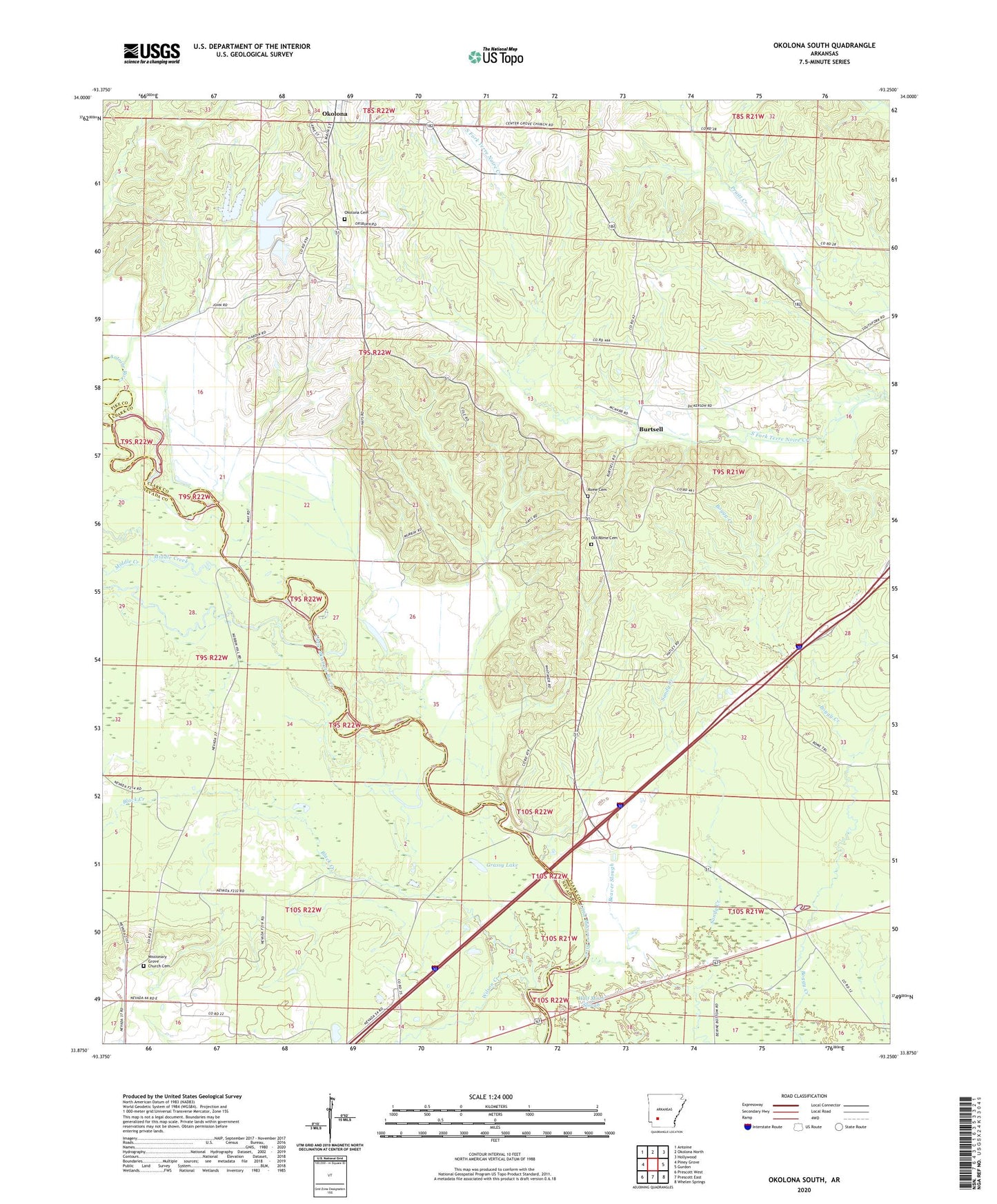
2024 topographic map quadrangle Okolona South in the state of Arkansas. Scale: 1:24000. Based on the newly updated USGS 7.5' US Topo map series, this map is in the following counties: Clark, Nevada, Pike. The map contains contour data, water features, and other items you are used to seeing on USGS maps, but also has updated roads and other features. This is the next generation of topographic maps. Printed on high-quality waterproof paper with UV fade-resistant inks.
Quads adjacent to this one:
West: Piney Grove
Northwest: Antoine
North: Okolona North
Northeast: Hollywood
East: Gurdon
Southeast: Whelen Springs
South: Prescott East
Southwest: Prescott West
This map covers the same area as the classic USGS quad with code o33093h3.
Contains the following named places: Antoine River, Black Creek, Burtsell, Cornelius Spring School, Grassy Lake, Half Moon Slough, Howard Creek, Maryetta Church, Middle Creek, Missionary Grove Church, Missionary Grove Church Cemetery, Native, Okolona, Okolona Cemetery, Old Rome Cemetery, Rome Cemetery, Saint Clair Church, Sandy Creek, Township of Antoine, Township of Boughton, Township of Elkins, Wilson Creek