MyTopo
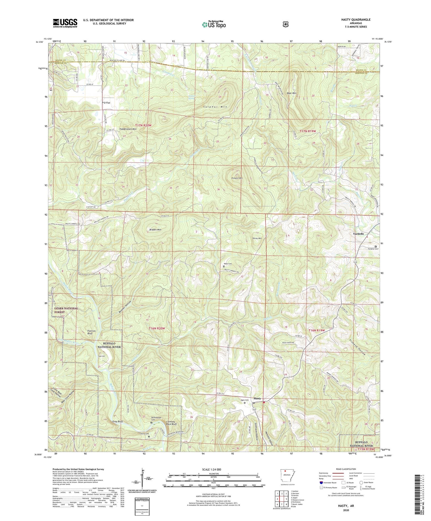
Hasty Arkansas US Topo Map
Couldn't load pickup availability
Also explore the Hasty Forest Service Topo of this same quad for updated USFS data
2024 topographic map quadrangle Hasty in the state of Arkansas. Scale: 1:24000. Based on the newly updated USGS 7.5' US Topo map series, this map is in the following counties: Newton, Boone. The map contains contour data, water features, and other items you are used to seeing on USGS maps, but also has updated roads and other features. This is the next generation of topographic maps. Printed on high-quality waterproof paper with UV fade-resistant inks.
Quads adjacent to this one:
West: Jasper
Northwest: Gaither
North: Harrison
Northeast: Everton
East: Western Grove
Southeast: Eula
South: Mount Judea
Southwest: Parthenon
This map covers the same area as the classic USGS quad with code o36093a1.
Contains the following named places: Agee Cemetery, Bat House Branch, Bear Cave Hollow, Boat Mountain, Boomer Hollow, Braden Mountain, Cedar Creek, Chimney Rock Bluff, Collins Cemetery, Deffenbaugh Cemetery, Flatiron Bluff, Fodderstack Mountain, Gray Bluff, Hasty, Hasty Post Office, Hasty Volunteer Fire Department, KCWD-FM (Harrison), Little Bear Cave Hollow, Little Buffalo River, Lost Hill, Marble Falls Post Office, P D Flat, P D Flat Church, Pinnacle Mountain, Rock Creek, Shirey Mountain, Sulphur Mountain, Sulphur Spring, Township of Hasty, Township of Mill Creek, Township of Prairie, Wells Cemetery, Wells Creek, Yardelle, Yardelle Branch, Yardelle Cemetery, ZIP Code: 72640