MyTopo
Western Grove Arkansas US Topo Map
Couldn't load pickup availability
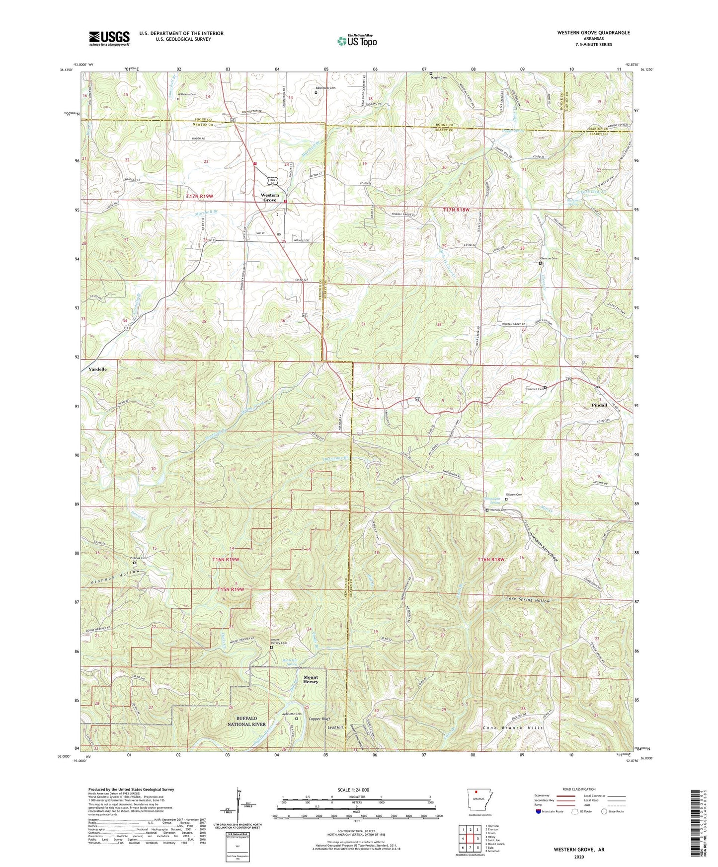
2024 topographic map quadrangle Western Grove in the state of Arkansas. Scale: 1:24000. Based on the newly updated USGS 7.5' US Topo map series, this map is in the following counties: Newton, Searcy, Boone, Marion. The map contains contour data, water features, and other items you are used to seeing on USGS maps, but also has updated roads and other features. This is the next generation of topographic maps. Printed on high-quality waterproof paper with UV fade-resistant inks.
Quads adjacent to this one:
West: Hasty
Northwest: Harrison
North: Everton
Northeast: Bruno
East: Saint Joe
Southeast: Snowball
South: Eula
Southwest: Mount Judea
This map covers the same area as the classic USGS quad with code o36092a8.
Contains the following named places: Aydelotte Cemetery, Bald Knob Cemetery, Cave Spring Hollow, Chinquapin Spring, Chinquapin Spring Ridge, Clutes, Copper Bluff, Davis Creek, Dugger Cemetery, Dugger Spring, East Fork Clear Creek, Glencoe Cemetery, Glencoe Spring, Hurricane Branch, Hurricane Mine, Kilburn Cemetery, Lead Hill, Mill Branch, Mitch Hill Spring, Mount Hersey, Mount Hersey Cemetery, Nichols Cemetery, Pindall, Pindall Post Office, Pinhook Cemetery, Pinhook Hollow, Plum Branch, Qualls Branch, Shaddock Branch, Spring Brook, The Old Western Grove Volunteer Fire Department, Town of Western Grove, Township of Grove, Township of New Hope, Township of Prairie, Trammell Cemetery, Union Church, West Fork Clear Creek, Western Grove, Western Grove Church of Christ, Western Grove High School, Western Grove Post Office, Western Grove School, Western Grove Volunteer Fire Department, Wilbourn Cemetery, ZIP Codes: 72669, 72685