MyTopo
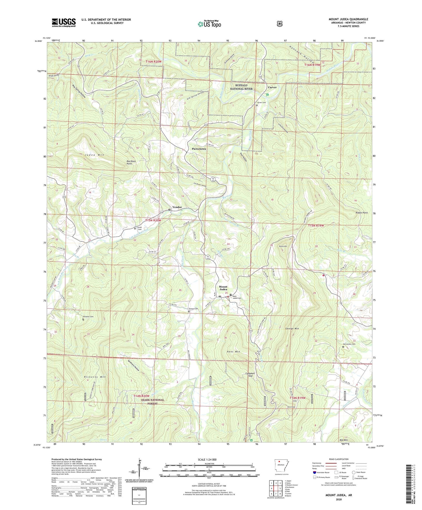
Mount Judea Arkansas US Topo Map
Couldn't load pickup availability
Also explore the Mount Judea Forest Service Topo of this same quad for updated USFS data
2024 topographic map quadrangle Mount Judea in the state of Arkansas. Scale: 1:24000. Based on the newly updated USGS 7.5' US Topo map series, this map is in the following counties: Newton. The map contains contour data, water features, and other items you are used to seeing on USGS maps, but also has updated roads and other features. This is the next generation of topographic maps. Printed on high-quality waterproof paper with UV fade-resistant inks.
Quads adjacent to this one:
West: Parthenon
Northwest: Jasper
North: Hasty
Northeast: Western Grove
East: Eula
Southeast: Moore
South: Lurton
Southwest: Deer
This map covers the same area as the classic USGS quad with code o35093h1.
Contains the following named places: Atkinson School, Bethlehem Church, Big Creek, Big Creek Church, Buffalo River State Wildlife Management Area, Campbell Gap, Carver, Carver Cemetery, Cave Spring Branch, Deal Hollow, Dick Knob, Dry Branch, Dry Creek, East Fork Cave Creek, Elm Spring Hollow, George Mountain, Hancock Hollow, Jim Brown Hollow, Kent Mountain, Left Fork Big Creek, Lick Creek, Lick Creek School, Lime Kiln Hollow, Log Hall Church, Loghall School, McCutchen Cemetery, Mount Judea, Mount Judea Cemetery, Mount Judea Census Designated Place, Mount Judea Elementary School, Mount Judea Fire Department Station 1, Mount Judea Fire Department Station 2, Mount Judea High School, Mount Judea Post Office, North Pole Knob, Old Time Pentecost Church, Piercetown, Piercetown Community Church, Red Rock Point, Ricketts Cemetery, Ricketts Mountain, Riddle Point, Rough Hollow, Round Mountain, Roy Spring Hollow, Sexton Cemetery, Sheldon Branch, Smith Cemetery, Stillhouse Hollow, Sweet Home School, Sycamore Hollow, Township of White, Vendor, Vendor Post Office, White House School, Youngs Creek, ZIP Codes: 72655, 72683