MyTopo
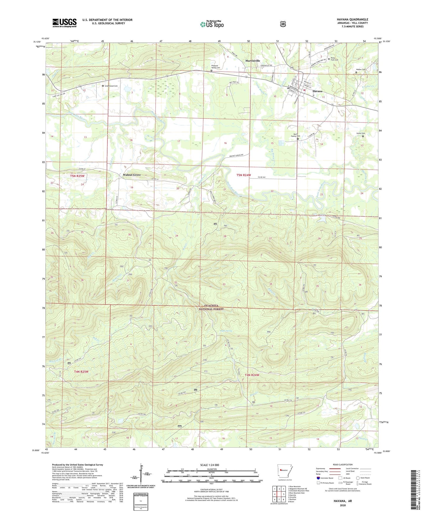
Havana Arkansas US Topo Map
Couldn't load pickup availability
Also explore the Havana Forest Service Topo of this same quad for updated USFS data
2024 topographic map quadrangle Havana in the state of Arkansas. Scale: 1:24000. Based on the newly updated USGS 7.5' US Topo map series, this map is in the following counties: Yell. The map contains contour data, water features, and other items you are used to seeing on USGS maps, but also has updated roads and other features. This is the next generation of topographic maps. Printed on high-quality waterproof paper with UV fade-resistant inks.
Quads adjacent to this one:
West: Blue Mountain Dam
Northwest: Blue Mountain
North: Magazine Mountain NE
Northeast: Chickalah Mountain West
East: Danville
Southeast: Rover
South: Bluffton
Southwest: Gravelly
This map covers the same area as the classic USGS quad with code o35093a5.
Contains the following named places: Big Piney Creek, Cedar Creek, City of Havana, Clear Creek, Davis Family Cemetery, Dentontown, East Cedar Creek, Guinn Cemetery, Havana, Havana / Moores Chapel Volunteer Fire Department, Havana Post Office, Jack Creek, Jones Lake Dam Number One, Little Piney Creek, Maple Spring, Marvinville, Marvinville School, Mill Creek, Moss Creek School, Owens Lake, Piney Fork Cemetery, Pleasant Valley Cemetery, Rogers Creek, Township of Riley, Truett Creek, Underwood Cemetery, Walker Cemetery, Walnut Grove, Walnut Grove School, Western Yell County High School, ZIP Code: 72842