MyTopo
Danville Arkansas US Topo Map
Couldn't load pickup availability
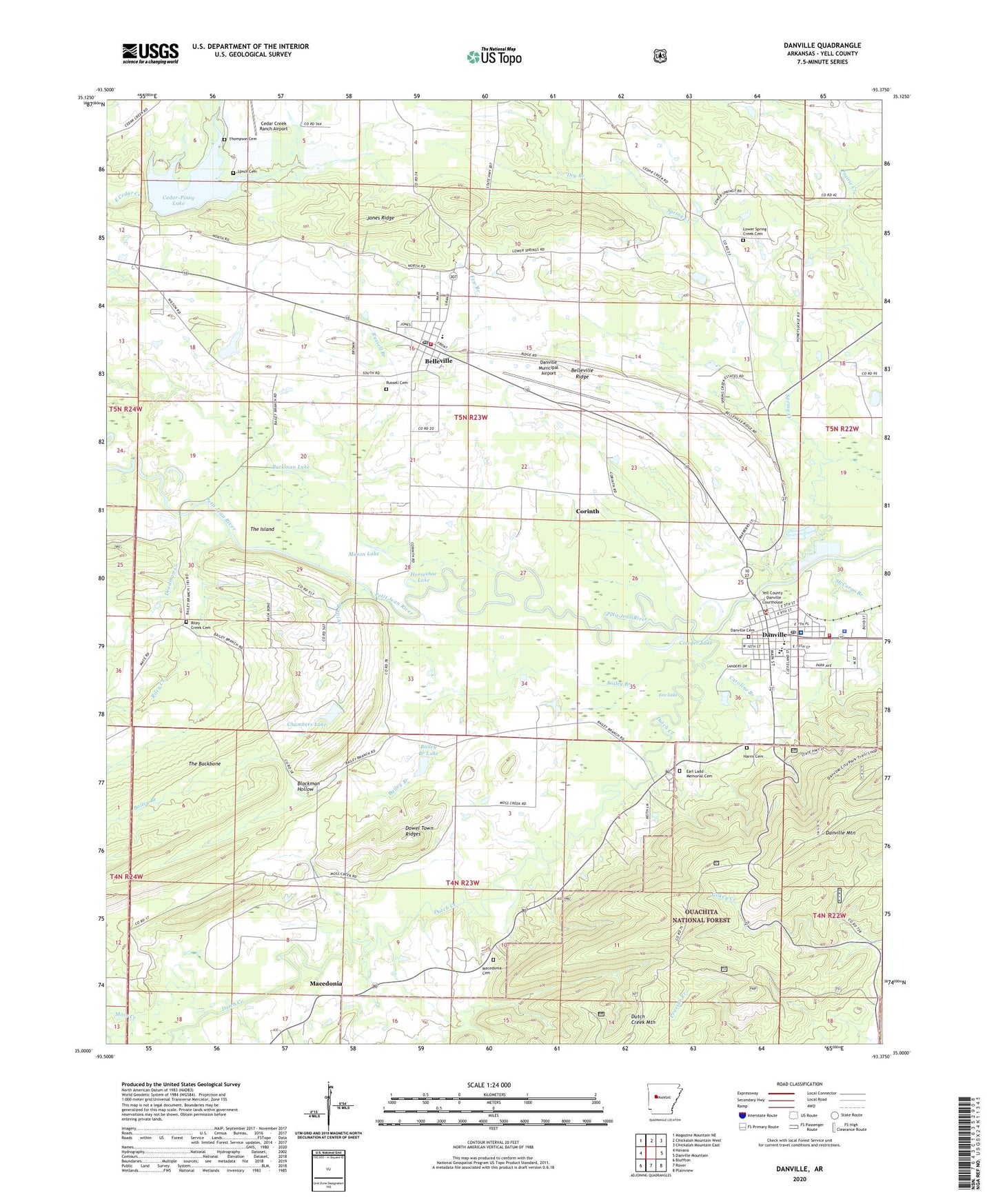
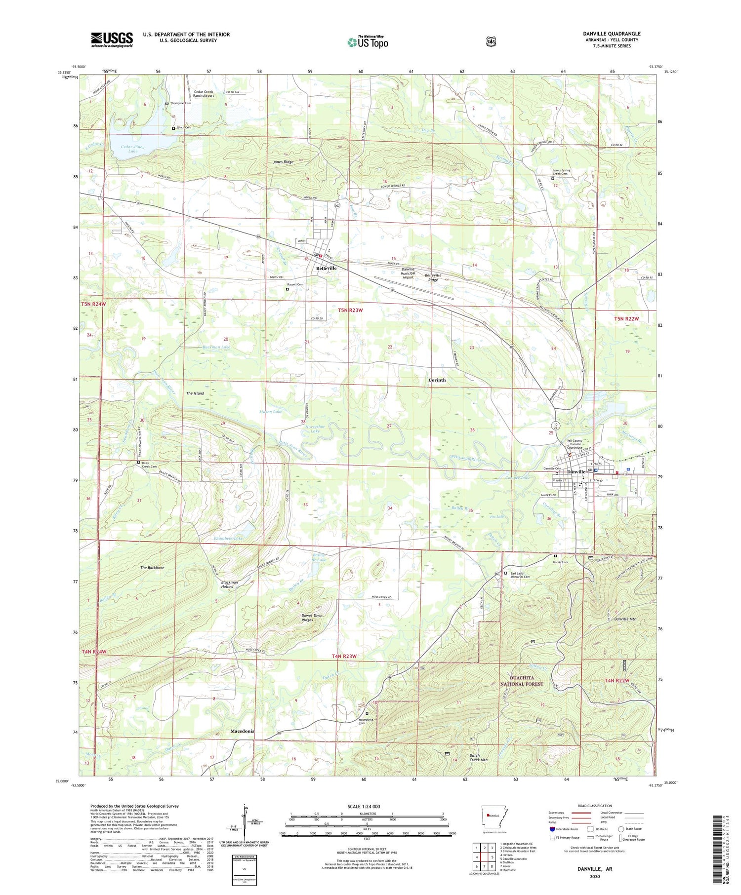
2024 topographic map quadrangle Danville in the state of Arkansas. Scale: 1:24000. Based on the newly updated USGS 7.5' US Topo map series, this map is in the following counties: Yell. The map contains contour data, water features, and other items you are used to seeing on USGS maps, but also has updated roads and other features. This is the next generation of topographic maps. Printed on high-quality waterproof paper with UV fade-resistant inks.
Quads adjacent to this one:
West: Havana
Northwest: Magazine Mountain NE
North: Chickalah Mountain West
Northeast: Chickalah Mountain East
East: Danville Mountain
Southeast: Plainview
South: Rover
Southwest: Bluffton
This map covers the same area as the classic USGS quad with code o35093a4.
Contains the following named places: 15th Judicial District Drug Task Force, 72833, Bailey Branch, Bailey Branch Lake, Bailey Branch R C and D Structure One Dam, Bailey School, Belleville, Belleville Fire Department, Belleville Post Office, Belleville Ridge, Blackman Hollow, Buckman Lake, Caroline Branch, Cedar Creek Ranch Airport, Cedar Hill School, Cedar Piney Lake Dam, Cedar-Piney Lake, Chambers Lake, Chambers Lake Dam, Chambers Memorial Hospital, City of Belleville, City of Danville, Corinth, Corinth School, Cowger Lake, Danville, Danville Cemetery, Danville Fire Department, Danville High School, Danville Municipal Airport, Danville Police Department, Danville Post Office, Deadman Creek, Dowel Town Ridges, Dry Branch, Dutch Creek, Earl Ladd Memorial Cemetery, Few Branch, Fourche Ranger Station, Fox Lake, Harris Chapel, Horseshoe Lake, Howell Cemetery, Jones Ridge, Little Petit Jean River, Lower Spring Creek Cemetery, Lower Spring Creek Presbyterian Church, Lower Spring Creek School, Lynch Cemetery, Macedonia, Macedonia Cemetery, Macedonia School, Mason Lake, McCargo Branch, Millan, Moss Creek, Petite Branch, Pleasant Home Church, Riley Creek, Riley Creek Cemetery, Russell Branch, Russell Cemetery, S C Tucker Elementary School, Spring Creek, Springdale Church, Surrat Slough, The Backbone, The Island, Thompson Cemetery, Town of Corinth, Township of Danville, Township of Ferguson, Township of Reed Keathly, Western Yell County Elementary School, Yell County, Yell County Emergency Medical Services, Yell County Hospital Heliport, Yell County Sheriff's Office - Danville Station