MyTopo
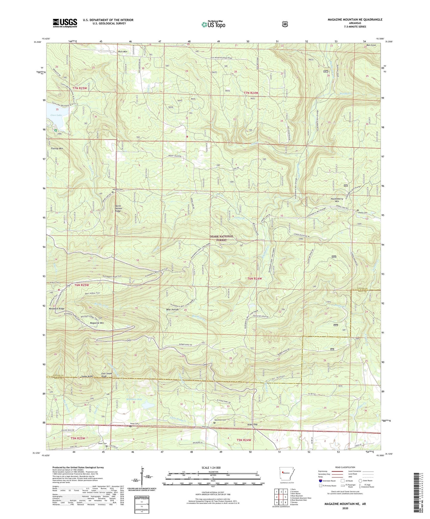
Magazine Mountain NE Arkansas US Topo Map
Couldn't load pickup availability
Also explore the Magazine Mountain NE Forest Service Topo of this same quad for updated USFS data
2024 topographic map quadrangle Magazine Mountain NE in the state of Arkansas. Scale: 1:24000. Based on the newly updated USGS 7.5' US Topo map series, this map is in the following counties: Logan, Yell. The map contains contour data, water features, and other items you are used to seeing on USGS maps, but also has updated roads and other features. This is the next generation of topographic maps. Printed on high-quality waterproof paper with UV fade-resistant inks.
Quads adjacent to this one:
West: Blue Mountain
Northwest: Paris
North: Scranton
Northeast: New Blaine
East: Chickalah Mountain West
Southeast: Danville
South: Havana
Southwest: Blue Mountain Dam
This map covers the same area as the classic USGS quad with code o35093b5.
Contains the following named places: Alder Gap, Antioch Cemetery, Barber Creek, Bear Hollow, Ben Cove, Big Piney Creek, Brushy Creek, Corley Mountain Rural Fire Department Station 2, Corley Mountain Rural Fire Department Station 3, Cove Lake, Cove Lake Campground, East End Recreation Area, East Snake Knob, Flattop Mountain, Gobbel Branch, Greenfield, Greenfield Recreation Area, Gulf Creek, Jestice Creek, Lee Creek, Liberty Cemetery, Liberty School, Millard, Mount Salem Church, Mountain Hole, North Pointer Ridge, Piney Cemetery, Piney School, Rocky Point School, Shoot Cemetery, Snake Knob, Township of Bear Wallow, Township of Mountain, Valentine Cemetery